Tag: tornadoes
-
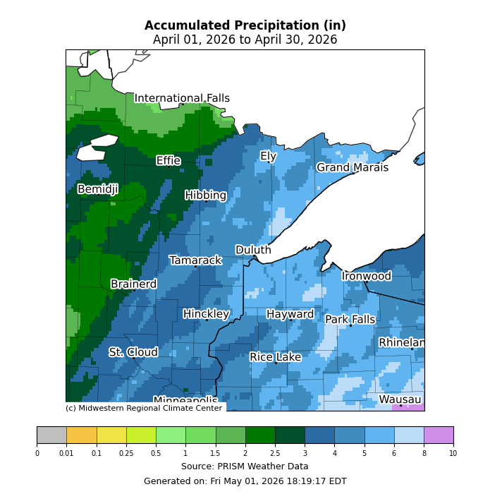
April 2026: Precipitation and Temperature Anomalies in the Northland
In April 2026, persistent troughing dominated the western U.S., while ridging stretched from the southern to eastern regions. This setup brought an active southwest upper-level flow and a busy weather pattern to the Northland, with cooler-than-average temperatures in northern Minnesota and warmer-than-average conditions in parts of northwest Wisconsin. Average temperatures…
-
Rain Fades Tonight; Frosty Nights on the Way
Much of the Northland has seen a rainy Monday, thanks to a strong low-pressure system lingering over far southeast Minnesota late this afternoon. The system will move northeast, eventually passing north of Lake Superior by Tuesday. Widespread rain will persist in the Northland northwest of the low tonight, but it’s…
-
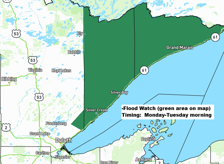
Rainy, Breezy Monday; Flood Watch North Shore
Widespread rain totals of about a half inch to an inch or more are expected in northeast Minnesota and northwest Wisconsin by late Monday night. This rain on already saturated soils in the Arrowhead of Minnesota and along the North Shore of Lake Superior may lead to excessive runoff and…
-
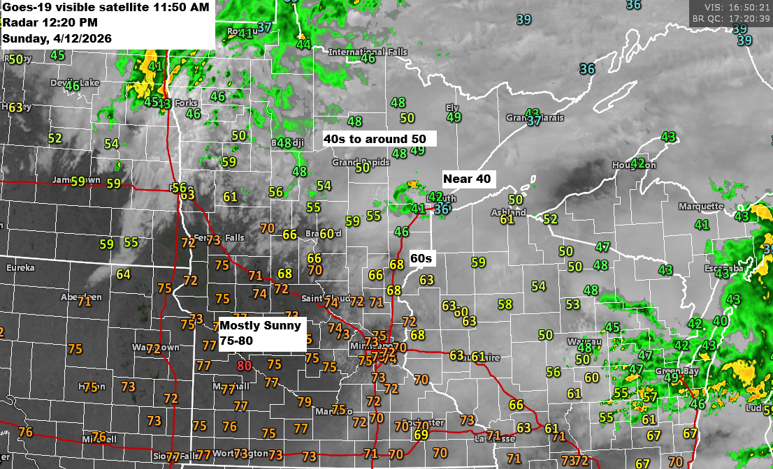
12 PM Weather Update for 4/12/2026: There’s a low chance of isolated strong to severe thunderstorms developing late this afternoon into the early evening.
Early this afternoon finds an area of low pressure over eastern North Dakota near Fargo with a warm front draped southeast through central Minnesota into central Wisconsin. For the rest of the day, the low will drift east-northeast, pushing the warm front farther north, while a cold front sweeps southeast…
-
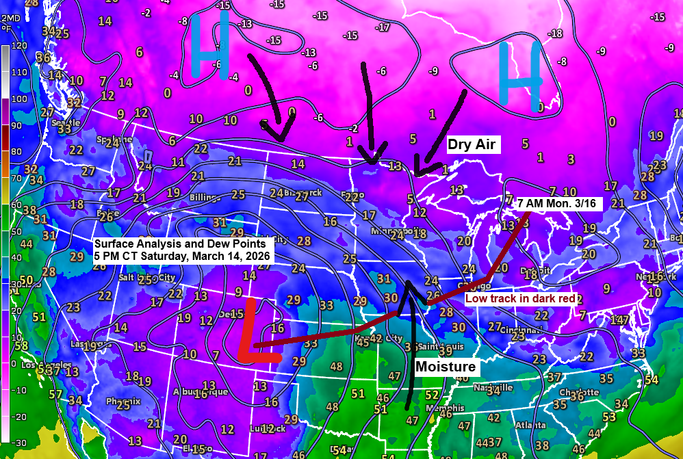
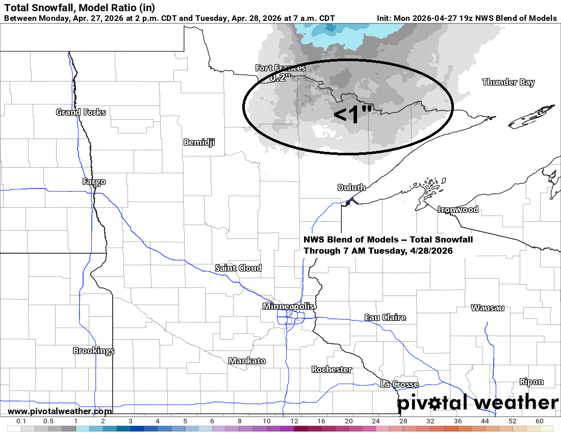
Winter Storm Update: Updated snowfall forecast as of 6 PM on Saturday, March 14, 2026.
A major winter storm is expected to sweep across much of the northern Plains, upper Midwest, and Great Lakes in the coming days, but predicting its impact is tricky, especially here in the Northland. High pressure sits to our north, while low pressure over eastern Colorado moves east-northeast toward Chicago,…
-
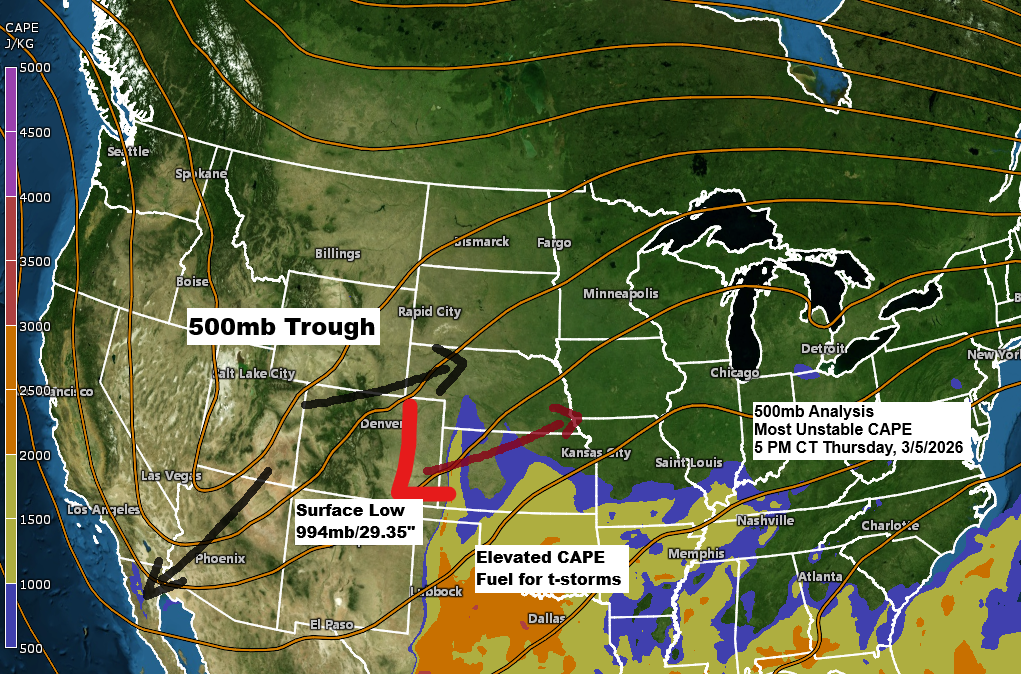
Dense fog and freezing drizzle into Friday morning; Some precipitation at times Friday-early Saturday
It’s a bit of a messy setup with a strong mid-to-upper level trough over the Rockies and a low-pressure system in eastern Colorado, with southwest winds aloft ahead of it. Normally, this kind of pattern could bring a strong storm to the upper Midwest, but this time the upper trough…
-
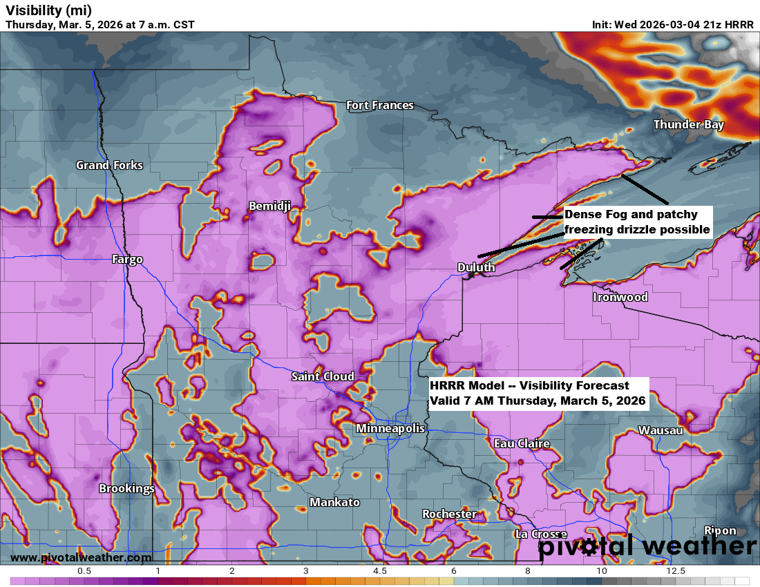
Windy, colder near Lake Superior — fog tonight, showers (rain/snow) Friday-early Saturday
Expect windy and much cooler conditions tonight and Thursday near Lake Superior, with northeast winds gusting up to 30 mph. There could also be areas of dense fog, along with the chance of patchy freezing drizzle that may leave a thin layer of ice on surfaces during this time. …NWS…