Tag: goes-16 satellite
-
Warm this weekend; Isolated showers possible Sunday
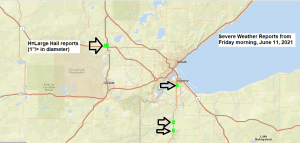
Who needs warm air near the surface for storms? We certainly don’t need that near Lake Superior. A perfect example of that was from this morning when we saw a line of scattered strong to severe thunderstorms impact portions of the Northland including Duluth and Superior with reports of quarter…
-

Scattered showers/t-storms tonight and Friday with areas of fog near Lake Superior; Turning breezy and much cooler near Lake Superior Friday; Warm but dry this weekend into most of next week
A Flood Advisory is in effect until 8:45 PM this evening including southeast Ashland County and southeast Iron County in northwest Wisconsin – Some locations impacted include Butternut. Heavy rain due to thunderstorms is occurring in the advisory area with 1 to 2 inches of rain fallen so far thru…
-
Warm temperatures continue through next week; A few showers/t-storms tonight through Friday
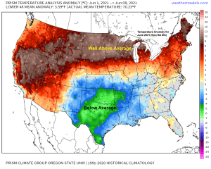
A very warm June thus far across the Northland, with monthly average temperatures thru the 8th running some 10 to 13 degrees warmer than average! Note: The warmest June on record in Duluth was in 1910 with an average monthly temperature of 65.5 degrees. June 2021 thru the 8th has…
-
Blustery and Cool near Lake Superior tonight and Monday; a little snow possible far south areas of the Northland late Monday-early Tuesday; March 2021 climate stats (thru the 13th)
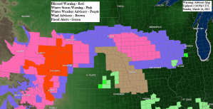
What a beautiful looking storm on satellite imagery today! Strong low pressure was over eastern Colorado this Sunday afternoon with deep moisture (green) wrapping into the low from SE to NW while dry air (beige) lifts NE. A textbook mid latitude cyclone on full display today. A look at today’s…
-
Local Snowfall, Precip and Wind Reports from the March 10-11, 2021 Winter/Spring Storm
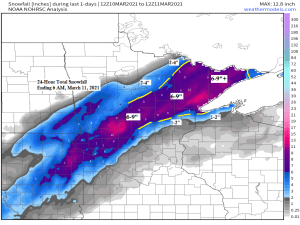
A strong winter/spring storm hit the Northland Wednesday afternoon into Thursday morning bringing widespread heavy rain and snow to much of northeast Minnesota and northwest Wisconsin. Precipitation totals of 1 to nearly 3 inches were reported from east-central and northeast Minnesota into northwest Wisconsin, making this one of the biggest…
-
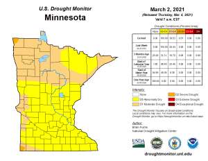
Dry weather continues into early next week; some rain (little snow) possible around March 9-11; drought update – moderate drought conditions expanding across Minnesota
The big story going forward is what happens to the ongoing and expanding drought across the upper Midwest? A lot of uncertainty here, but basically there’s two options, either a wet weather pattern locks in for weeks or months to erase this ongoing, slowly worsening drought, or we stay very…
-

A few snow chances ahead; mild temps Friday-Saturday followed by cooler temps Sunday-Monday; drought update
We’ve got three systems that will be impacting the upper Midwest thru early next week. System one moves through Friday evening System two comes through Saturday night-Sunday morning System three moves through Sunday night-early Monday morning The first system doesn’t look to produce a whole lot of precipitation, with only…