Category: wind
-
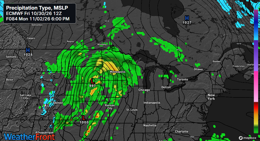
🌧️Rainy Stretch Ahead: Scattered Weekend Showers Before a Multi-Day Soaker
We’ve got a real soaker on the way next week as a slow-moving low-pressure system tracks east-northeast out of the Rockies. The system is expected to bring widespread rainfall to the Northland from Monday into Tuesday, with some wrap-around showers potentially lingering into Wednesday and Thursday. At this time, all…
-
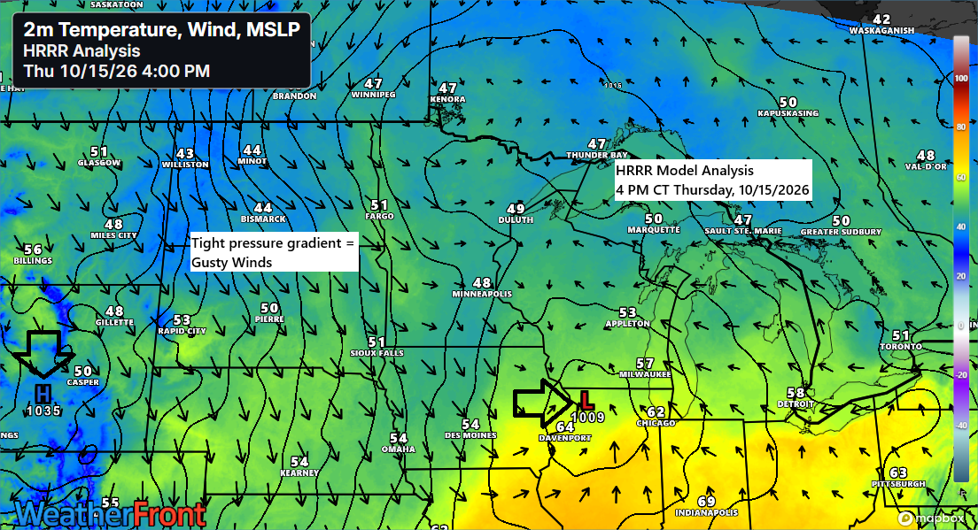
🌬️🌧️🌊Lake Superior Gale Friday, Then a Quick Weekend Warmup
Today has been all about two systems: a strong northern stream trough digging southeast out of the Dakotas, and a southern stream system moving east-northeast from the central Plains. Southwesterly flow aloft carried moisture northeast ahead of these systems, bringing a rainy Thursday to northwest Wisconsin and east-central and northeast…
-
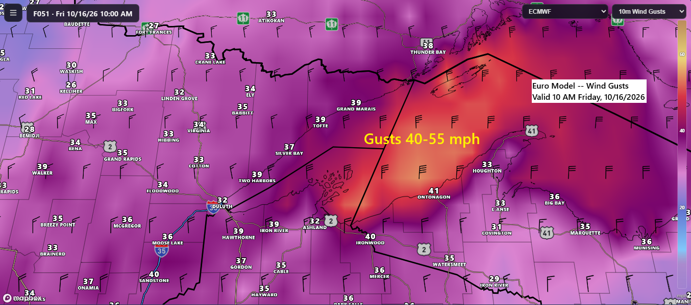
🌧️💨🌊Showers Thursday, then a Windy Friday with Lake Superior Gales
A cold front and a strong upper-level trough will move through the Northland on Thursday, bringing scattered showers and ushering in a period of gusty northwest winds. The strongest winds are expected to develop Thursday night and persist into midday Friday, with gusts of 20 to 35 mph likely across…
-

🌦️🌬️Fast-Moving Cold Front Brings Wind, Limited Rain Chances Late This Week
On Thursday, a low-pressure system will head toward the central Plains, while a strong trough and cold front push southeast toward the upper Midwest. The northern trough will help keep the southern system and its widespread rain away from the Northland, though a few showers might pass through our area…
-

⚡🌧️Rain Tonight, Then 💨Gusty Northwest Winds and Lake Superior Gales 🌊Thursday Night Into Friday
Rain and isolated thunderstorms are expected in the Northland tonight, with showers tapering off overnight. The heaviest rain will be in far northern Minnesota and the Arrowhead region, where half an inch or more is possible, while areas farther south, including Duluth, will see much lighter amounts. Radar loop from…
-
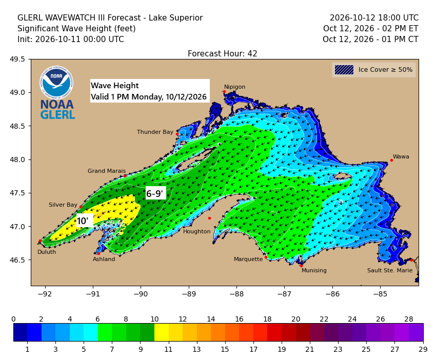
💨🌊🌧️Lake Superior Kicks Up: 45 MPH Gusts and 10-Foot Waves Possible
…Gales on western Lake Superior Monday… East to northeast winds will pick up over western Lake Superior on Monday, with gusts hitting 25 to 45 mph. Waves are expected to build to 5 to 10 feet, with the biggest swells likely from late morning through mid-evening. In Duluth, northeast winds…
-
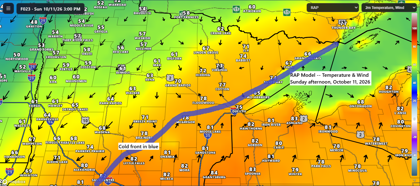
🌡️💨 Near-Record Warmth Sunday Before a Windy, Much Cooler Monday
Sunday promises another warm day with the potential for more record highs. Temperatures in northeast Minnesota and northwest Wisconsin will range from the 70s to low-to-mid 80s, while northern Minnesota will cool down behind a cold front, with highs in the 50s and 60s. Record Highs for October 11 International…