Category: thunderstorms
-
Storm Risk Friday, Then High‑Altitude Smoke Brings Haze Into the Weekend
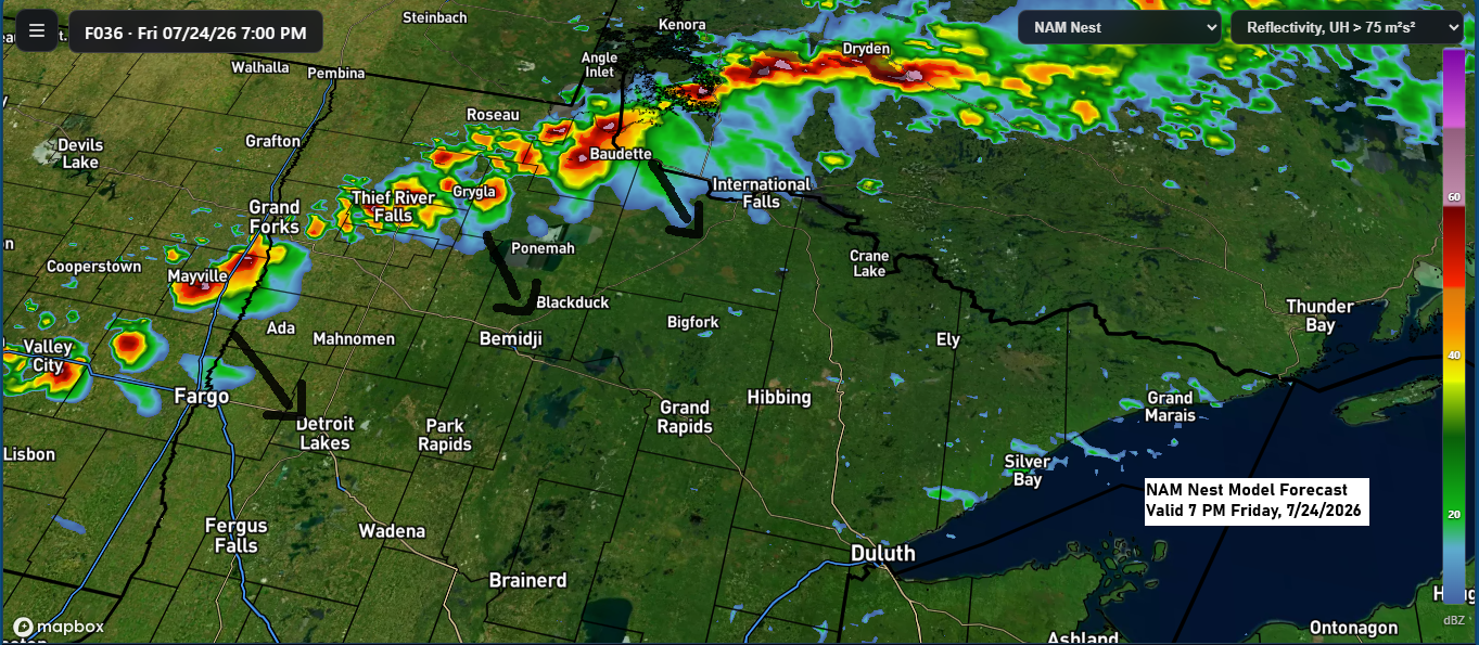
A few strong to severe thunderstorms could develop from late Friday afternoon into the evening, mainly across parts of the eastern Dakotas into west-central and northern Minnesota. This is where conditions may come together to support the risk for some severe storms. Late Friday afternoon and evening, the main severe…
-
Another 80° Day in Duluth—Next Up: Gusty Morning Storms Monday
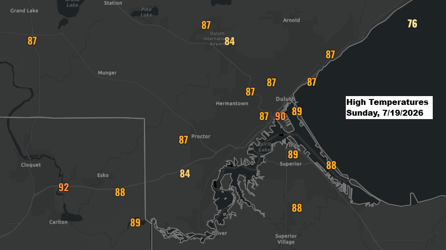
Today, July 19th, was the 16th day this month in Duluth, Minnesota, with a high of 80 degrees or warmer. On average, July sees about 11 such days, with the record being 25 days set in 2012. Today in the Northland, temperatures mostly hovered in the mid to upper 80s,…
-
Low Overnight Storm Chances Tonight, Then a Remarkable 597–600 dam Ridge Builds Into the Northland Early Next Week
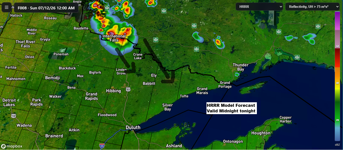
While chances are low, some model runs today suggest showers and thunderstorms could form over far northern Minnesota or southern Ontario tonight. If they do develop, they’d likely track southeast early Sunday morning. There’s plenty of instability and moisture in the air to support storms but rising heights from a…
-
Northland Forecast: Storm Chances Friday, Then Intense Heat Builds
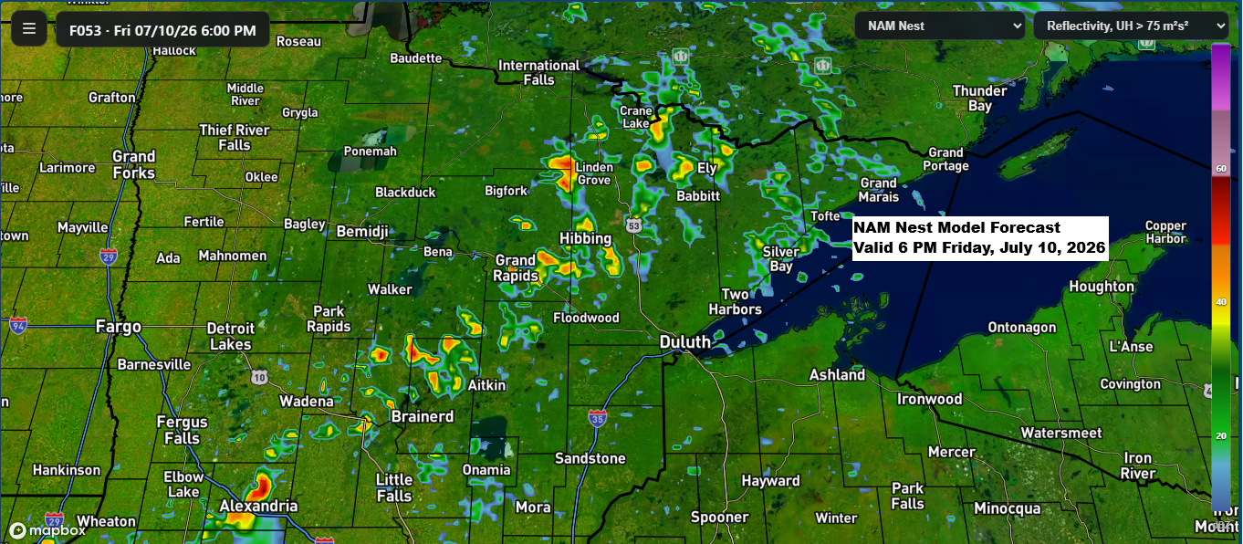
A northwest flow aloft, paired with some lingering moisture and instability over the Northland, along with a boundary moving in from the northwest, looks like it could spark a few showers and thunderstorms Friday afternoon into the evening. While severe weather doesn’t seem likely right now, that could change in…
-

Heavy Rain Tonight Along a Stalled Front; Massive 600 dam Ridge Builds Next Week
A frontal boundary acting more like a stationary front extending from central South Dakota to northeast Minnesota will be the focal point for showers and thunderstorms tonight into Wednesday morning. Precipitable water of 1.5 to 2 inches near and south of this front will lead to torrential downpours tonight, while…
-

Late Monday Through Wednesday: Better Chances for Showers and Storms
In the coming days, a cold front will move southeast into the upper Midwest and likely stall by Tuesday night into Wednesday. Moisture and instability gathering near the front, along with some energy moving through, will bring higher chances of showers and thunderstorms to parts of the Northland from late…
-
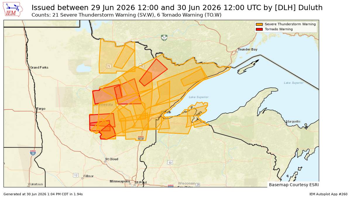
27 Warnings in a Day: Northland Severe Weather Recap & What’s Next
On Monday, June 29, 2026, the National Weather Service in Duluth, Minnesota, issued a total of 27 warnings, including 21 for severe thunderstorms and 6 for tornadoes, across northeast Minnesota and northwest Wisconsin. It was certainly a busy day for severe weather in the area. Note: Several additional storm reports…