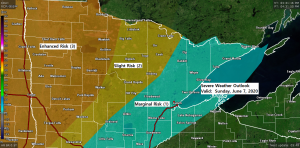
Category: Enhanced Risk
-
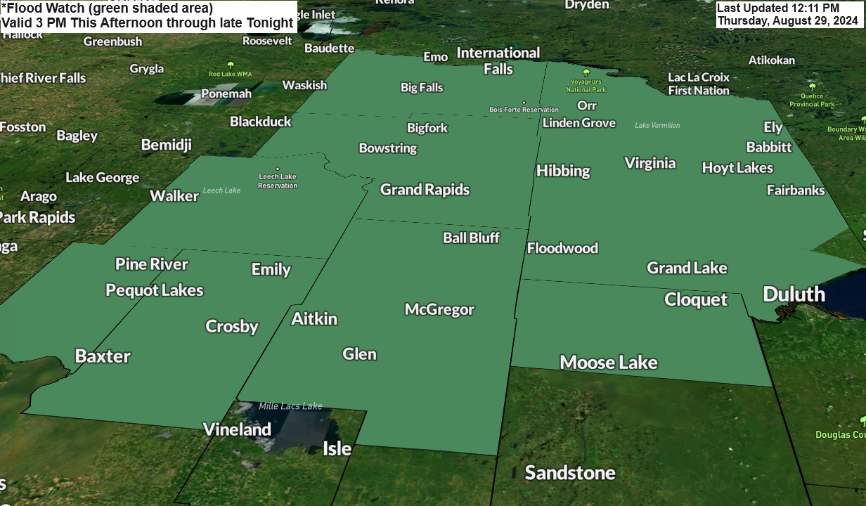
Northeast Minnesota & Northwest Wisconsin Weather Alert: Flood Watch and Severe Thunderstorms
1:18 PM Thursday, August 29, 2024
-

High Precipitable Water Values and Severe Thunderstorm Potential
12:20 PM Monday, August 26, 2024 Sunday proved to be fruitful as I gained three new paid subscribers to my blog, increasing the total to six. I hope to see this number grow further. My gratitude goes out to those who have subscribed so far. Considering the strength of the…
-
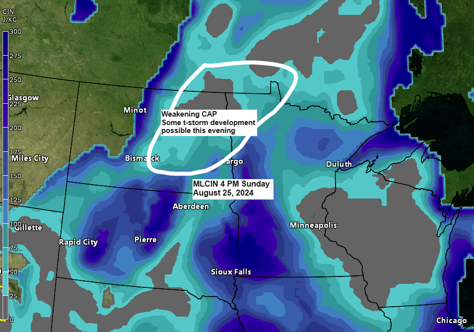
Northland Weather Forecast: Thunderstorms and Severe Weather Risk
6:17 PM Sunday, August 25, 2024 Thank you, jday08, for subscribing to my blog; your support is greatly appreciated! I’ve reached 3 paid subscribers now, and I’m hopeful that this number will keep growing. A big thank you to everyone who has subscribed thus far. Signs of a weakening cap…
-
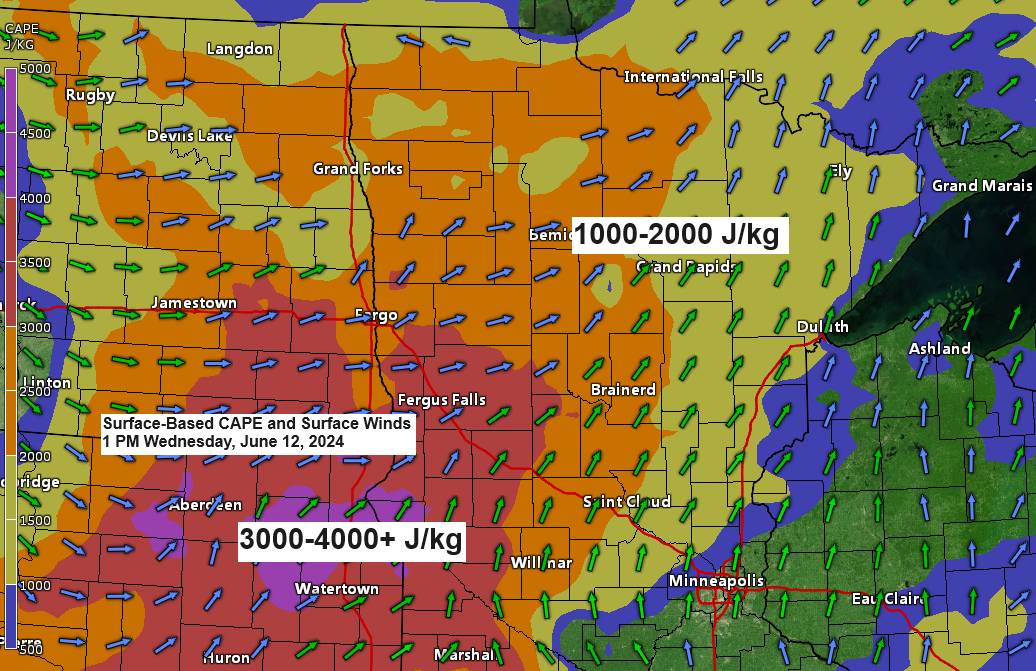
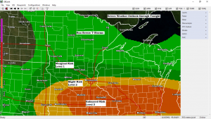
Severe Thunderstorms late this afternoon into this evening
1:30 PM Wednesday, June 12, 2024 Scattered to numerous severe thunderstorms may occur across a broad area of northeast Minnesota and far northwest Wisconsin later this afternoon and into the evening. The primary window for potential severe thunderstorms to traverse the Northland region is approximately between 4 PM and 11…
-
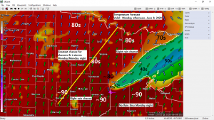
Areas of fog along with a cool breeze near Lake Superior; very warm and muggy inland (near record warmth Monday?) risk for showers/t-storms mainly over northern Minnesota through Monday night
We’ve got quite an interesting weather pattern right now, but at the same time it’s a frustrating one, especially for areas that need rain, like Duluth (-4.02″ below normal precipitation since January 1st) I’ll try to break down what’s going on now and what may happen over the next few…
-
Turning warm with a tropical feel by Monday, but much cooler near Lake Superior; rounds of rain/thunder the next few days
We’ve got quite an interesting weather pattern setting up the next few days. 1: An upper level trough across the western U.S. will be moving to the ENE reaching the Northern Plains and upper Midwest. 2: Tropical Storm Cristobal heading north over the western Gulf of Mexico and likely to…
-
Tuesday afternoon weather update
There’s been some rain late this morning/afternoon across portions of north-central and east-central Minnesota, but rainfall totals have been on the light side – See totals below. Note: Rainfall totals through 2 PM Tuesday, June 2, 2020 Source: https://mesowest.utah.edu Brainerd, MN: 0.06″ Pine River, MN: 0.06″ Aitkin: 0.02″ Longville, MN:…