Category: Fire Danger
-
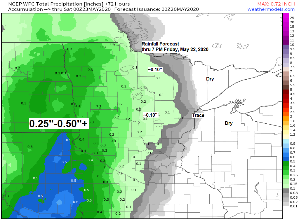
Dry through Thursday; few showers possible this weekend
A little more moisture in the form of higher dew points will be moving into the Northland over the next few days with dew points in the 40s and 50s, this may eventually lead to some fog/low clouds at times near Lake Superior beginning Wednesday evening, and possibly continuing into…
-
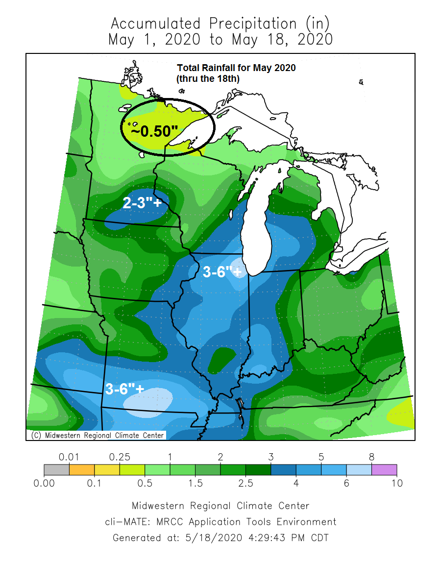
Dry pattern continues across the Northland! Warm inland while cool breezes linger near Lake Superior
Dry weather continues across the Northland for the next few days. Warmest temperatures will be found inland from Lake Superior by some 10 to 20 miles. Daytime highs for inland locations will be in the 60s and 70s Tuesday, Wednesday and Thursday with easterly winds 5 to 15 mph with…
-
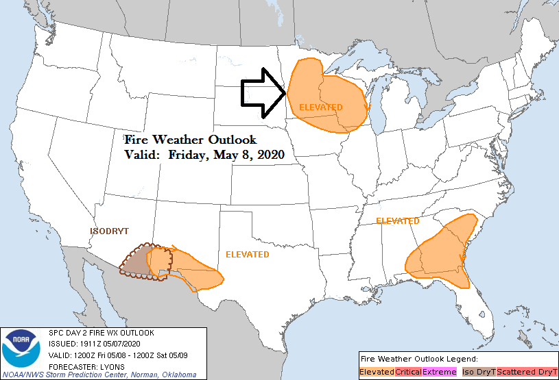
Bone Dry! Cool and breezy with elevated fire weather conditions into the weekend
-Temperatures are running about 10 to 15 degrees cooler across the Northland this afternoon compared to Wednesday afternoon, and Friday will even be a little cooler with highs only in the upper 30s to middle 40s, well below normal for May 8th. -Record or near record cold is possible over…
-
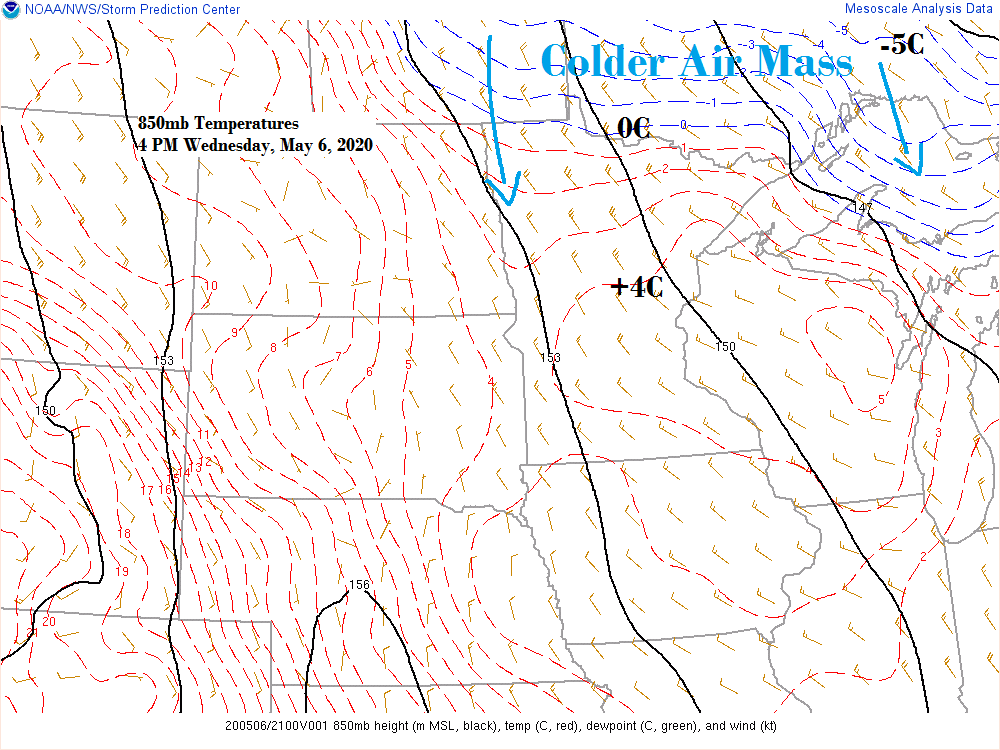
Mainly dry with below normal temperatures through the middle of next week
-Today (Wednesday) was likely the last time we see 60 degree temperatures in Duluth until maybe late next week at the earliest, and 60s are right where we should be this time of the year. -Cooling trend begins Thursday with highs across the Northland in the 40s and 50s. Winds…
-
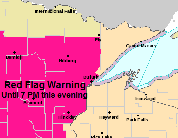
Critical Fire Weather Conditions continue this evening; cooler Sunday; rain and possibly some snow/mixed precip late Monday-Tuesday
Extreme (red) to High Fire Danger (yellow) covers all of Minnesota through this evening. Note: The fire situation is rated as explosive in the extreme category. Source: https://www.dnr.state.mn.us/ -Red Flag Warning continues until 7 PM this evening for portions of north-central, northeast and east-central Minnesota (hot pink area on map)…
-
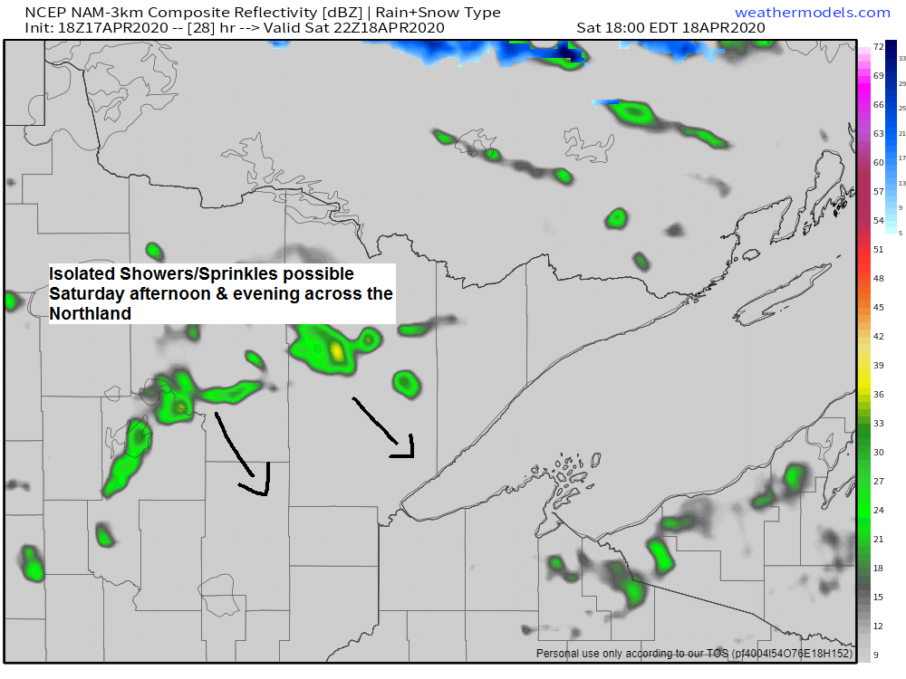
Breezy weekend ahead! Mild Saturday; a little cooler Sunday
A cold front will move SE through the Northland on Saturday, this front should come through mostly dry, but a few showers or sprinkles could pop up especially in the afternoon and evening. Simulated radar valid from 1 PM to 11 PM Saturday Source: 18z NAM-WRF model 4.17.2020; https://weathermodels.com/ A…