Tag: flash flooding
-
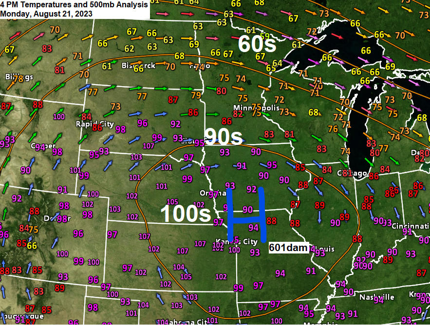
Scattered showers/t-storms with heavy rain possible late tonight-early Tuesday morning; Cool Lake wind continues in Duluth through Wednesday; Major heat wave continues the next few days in parts of the Central Plains and upper Midwest
6:25 PM Monday, August 21, 2023 A massive heat dome with 500mb heights of 601dam was over the Central Plains this afternoon and temperatures are cooking under this upper-level ridge today with widespread 100s across the Central Plains while heat index values ranged from around 110 to 125 degrees late…
-
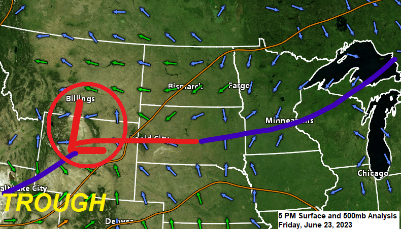
Rainy at times through Sunday with some wildfire smoke (Air Quality Alert in effect through 3 PM Saturday for NE MN, and through 11 PM Saturday in NW WI)
6:33 PM Friday, June 23, 2023 Here’s something I haven’t said in a long time — A wet weekend ahead! An area of low pressure will move east-northeast out of Wyoming tonight while a cold front over the southern half of Minnesota lifts north as a warm front on Saturday,…
-

Some rain at times Wednesday night through this weekend; Much cooler temps near Lake Superior with a gusty NE wind Wednesday and again Friday
5:38 PM Tuesday, September 13, 2022 *A wetter pattern develops in the Northland the rest of this week with the first chance for scattered showers coming late Wednesday afternoon/night, followed by a greater chance for rain for Thursday and Friday, this rain won’t be continuous, however, with dry hours mixed…
-

Occasional showers/t-storms with a potential for heavy rain tonight and Monday; A cool week ahead near Lake Superior; Warmer temperatures inland
5:18 PM Sunday, July 3, 2022 There is a chance for heavy rain which may lead to flash flooding late tonight into early Monday morning over parts of the Northland, with the higher chances covering the Brainerd Lakes area, east toward Hinckley and Siren. Thunderstorms are expected to become more…
-

A brief surge of heat and humidity (away from Lake Superior) Tuesday otherwise near to slightly above normal temps this week with some showers/t-storms tonight and Monday
6:43 PM Sunday, June 12, 2022 Scattered showers and thunderstorms are possible over much of the Northland later tonight and Monday, and some of these storms could produce heavy rain with a marginal (5%) risk for flash flooding centered on southern parts of the Northland. 18z NAM 3km model simulated…
-

A cooler and gusty east wind returns near Lake Superior Wednesday and Thursday, highs near 90 possible southern parts of the Northland on Thursday; Occasional showers/t-storms Wednesday PM-early Friday AM
8:20 PM Tuesday, May 10, 2022 The weather locally will remain on the quiet side tonight through Wednesday morning, but after that will likely be dealing with a few rounds of showers and thunderstorms between Wednesday afternoon and early Friday morning. Severe Weather Ingredients for Wednesday and Thursday. 1: A…
-
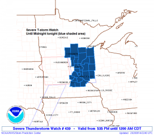
Severe Thunderstorm Watch issued for parts of the Northland
5:58 PM Friday – A severe thunderstorm watch has been issued for eastern Minnesota and western Wisconsin effective this Friday afternoon from 5:35 PM until Midnight CDT. Primary threats include Damaging wind gusts to 70 mph Large hail to 1.5 inches in diameter A tornado or two possible Counties in…