Tag: flash freeze
-
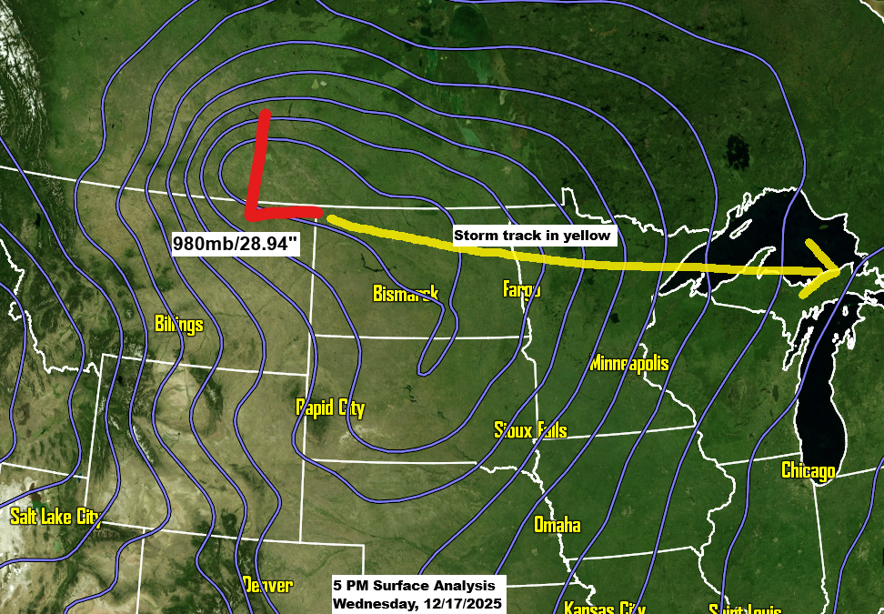
A powerful clipper is set to bring a variety of weather conditions to the Northland in the next 24 hours.
A strong low-pressure system over southern Saskatchewan this afternoon will move east-southeast, passing over far northern Minnesota Thursday morning before reaching eastern Lake Superior by around 6 PM Thursday. Over the next 24 to 36 hours, this system will bring snow, rain, wind, and a burst of arctic air to…
-

Turning Windy and Colder! Rain this evening turning to snow late tonight-Wednesday morning; Flash Freeze potential in parts of the Northland Wednesday morning; Warmer this weekend; Pattern turns colder and potentially snowier next week
6:02 PM Tuesday, February 14, 2023 Rain continues in the Northland this evening, but we will see the rain change to snow in northwest portions of the area (northern Minnesota) before Midnight, and this changeover from rain to snow will spread farther southeast across the area overnight/early Wednesday morning. For…
-
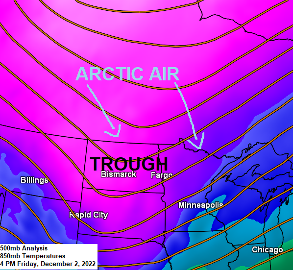
Snow this evening; Arctic Air arrives tonight, lingers through Saturday; Strong winds with areas of blowing snow tonight-Saturday morning; More chances for snow next week
5:18 PM Friday, December 2, 2022 A variety of weather headlines in effect for much of the Northland tonight through early Saturday morning. Snow across the Northland this evening with a brief mix of precipitation possible early this evening in northwest Wisconsin and eastern Minnesota. Snow ends from W-E by…
-

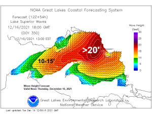
A Powerful Storm to hit the upper Midwest with a variety of impacts likely tonight and Thursday
This will be a storm to remember because of the variety of weather it will bring to the Northland, including a highly unusual risk for severe weather and tornadoes in parts of Minnesota and Wisconsin in mid-December! POTENTIAL IMPACTS TONIGHT AND THURSDAY Damaging winds with tree and power line damage…
-
A powerful storm on the way late Wednesday into early Thursday bringing rain, a risk for severe t-storms (isolated tornadoes), snow, widespread high winds (power outages), rapidly falling temperatures (possible flash freeze), and hurricane force wind gusts over parts of Lake Superior
A powerful storm will impact the upper Midwest from late Wednesday into early Thursday. This storm will bring a variety of hazards to the Northland, including rain, fog, snow, falling temperatures, possible flash freeze, thunderstorms, high winds and possible power outages. I’ll break down each one of these hazards in…
-

A fast moving but powerful storm set to hit the Northland with a variety of impacts possible for late Wednesday-early Thursday
One more quiet day ahead for Tuesday which will be followed by a brief period of active weather for Wednesday into early Thursday as a powerful area of low pressure moves quickly to the northeast out of the Rockies and Western High Plains — This system looks to bring a…
-
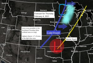
Some snow possible Thursday; arctic blast this weekend into early next week with wind chill advisories/warnings likely
Snow chances return to northeast Minnesota and northwest Wisconsin on Thursday, and there is even a chance for some patchy freezing rain/freezing drizzle in parts of the area before precipitation goes over to snow. Note: Another thing to keep an eye on is the potential for a ‘flash freeze’ in…