Tag: heavy rain
-
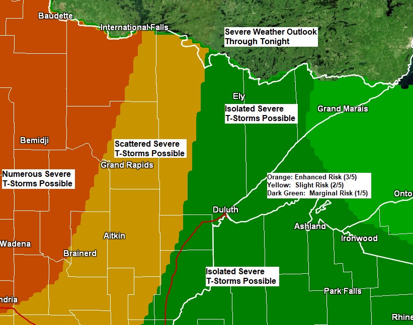
Shower/thunderstorm chances through Saturday; Lake wind develops with cooler temps near Lake Superior by late this afternoon
12:24 PM Friday, June 24, 2022 Showers and thunderstorms are likely in the Northland later today through Saturday with a couple different rounds of rain and storms expected. The greatest potential for severe thunderstorms later today and tonight covers western portions of the Northland including the cities of International Falls,…
-
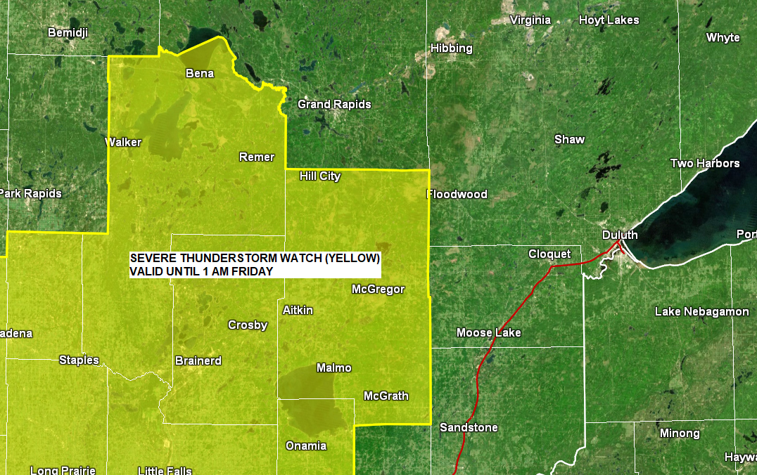
Severe Thunderstorm Watch issued for parts of the Northland
6:17 PM Thursday, June 23, 2022 A Severe Thunderstorm Watch has been issued for parts of central and west-central Minnesota and northeast South Dakota until 1 AM tonight. Some cities in the Northland included in this watch are Cass Lake, Walker, Backus, Remer, Longville, Leader, Pillager, Brainerd, Nisswa, Pine Center,…
-

Warm and turning more humid Thursday and Friday with scattered showers/t-storms possible; Cooler and less humid this weekend
8:17 PM Wednesday, June 22, 2022 Much of the day Thursday looks dry in northeast Minnesota and northwest Wisconsin with warm southerly winds and a slightly muggier air mass compared to the less humid weather we had today (Wednesday). A few showers and thunderstorms are possible by mid or late…
-

A risk for strong to severe thunderstorms and heavy rain tonight; Record Warmth in the Northland today; Still warm but turning less humid Tuesday
6:54 PM Monday, June 20, 2022 Very humid and warm conditions tonight with a risk for strong to severe thunderstorms. Warm weather continues Tuesday although not the extreme heat that we’ve seen the last few days. Tuesday will start out on the muggy side, but a much drier air mass…
-

A brief surge of heat and humidity (away from Lake Superior) Tuesday otherwise near to slightly above normal temps this week with some showers/t-storms tonight and Monday
6:43 PM Sunday, June 12, 2022 Scattered showers and thunderstorms are possible over much of the Northland later tonight and Monday, and some of these storms could produce heavy rain with a marginal (5%) risk for flash flooding centered on southern parts of the Northland. 18z NAM 3km model simulated…
-

Flood Watch issued for parts of the Northland; Rounds of showers and thunderstorms through Monday night with a threat for heavy rain (flooding) and a risk for some strong-severe storms
10:49 AM Sunday, May 29, 2022 Flood Watch in effect through Tuesday morning for parts of north-central and northeast Minnesota including the cities of Pine River, International Falls, Ely, Brainerd, Hill City, Grand Rapids, Walker, and Bigfork. Flash flooding caused by excessive rainfall possible. Several rounds of thunderstorms are expected…
-
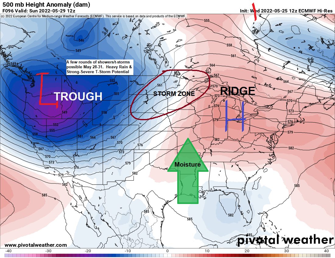
Active weather at times into early next week with warmer temperatures and more humid conditions (cooler near Lake Superior) Flood Update
5:31 PM Wednesday, May 25, 2022 Rain in parts of northeast and far eastern Minnesota and all of northwest Wisconsin will gradually end tonight. Gusty NE winds (20-35 mph) continue near Lake Superior this evening. Nicer weather returns Thursday but more so on Friday with widespread 70s for daytime highs…