Tag: heavy rain
-

Forecast: Heavy Rain and Thunderstorms Possible Late Monday-early Tuesday
Before Monday arrives, we have one more cool night ahead, with patchy frost possible in parts of northeast Minnesota and northwest Wisconsin, especially inland from Lake Superior. Tonight’s lows will be in the 30s and 40s, but record-breaking cold is not expected, unlike the past few nights. Showers and thunderstorms…
-
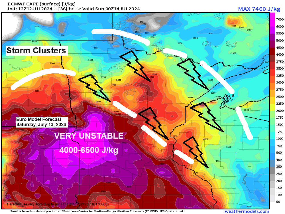
The weather over the next few days will feature scattered showers and thunderstorms, along with warm and humid conditions.
5:43 PM Friday, July 12, 2024 The weather forecast indicates that northeast Minnesota and northwest Wisconsin will experience a couple rounds of showers and thunderstorms from Saturday morning through Monday. Be prepared for changing weather conditions and stay safe! From Saturday through Monday, some storms may become strong to severe,…
-
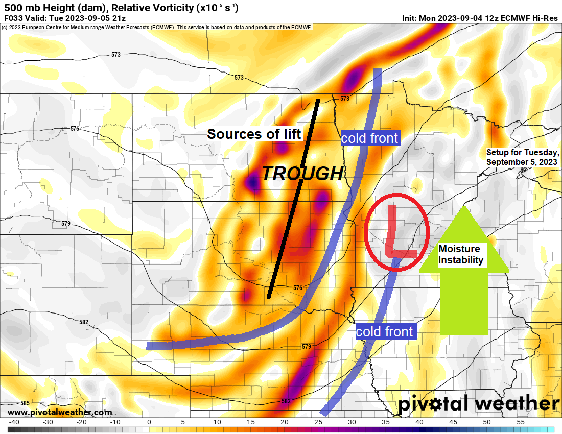
Showers/t-storms on the way Tuesday with some lingering rains into Wednesday; Turning much cooler Wednesday; More record warmth in the Northland today
6:12 PM Monday, September 4, 2023 Our September heat wave will continue on Tuesday although temperatures won’t be quite as hot as they have been the last few days, and that’s because of more clouds and showers and thunderstorms which will develop and move across the Northland during the day…
-
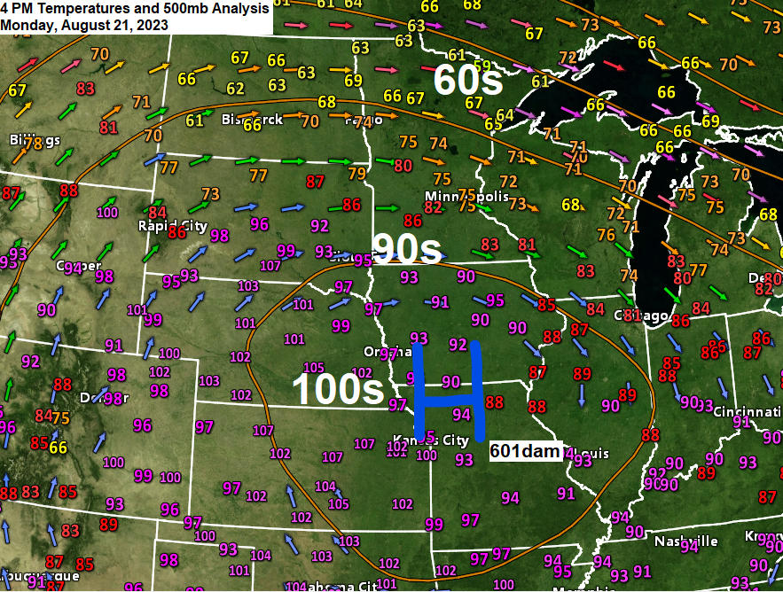
Scattered showers/t-storms with heavy rain possible late tonight-early Tuesday morning; Cool Lake wind continues in Duluth through Wednesday; Major heat wave continues the next few days in parts of the Central Plains and upper Midwest
6:25 PM Monday, August 21, 2023 A massive heat dome with 500mb heights of 601dam was over the Central Plains this afternoon and temperatures are cooking under this upper-level ridge today with widespread 100s across the Central Plains while heat index values ranged from around 110 to 125 degrees late…
-
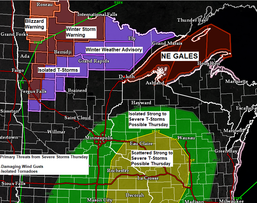
A strong fall storm will bring a variety of precipitation types and strong NE winds to the Northland through early Friday
5:28 PM Wednesday, November 9, 2022 A strong fall storm will impact the upper Midwest through early Friday morning. This storm will bring multiple hazards to the area, including heavy snow and blizzard conditions NW of the storm track to a risk for a few strong to severe thunderstorms SE…
-

A nice Saturday; Strong to Severe Thunderstorms possible Sunday/Sunday night
7:00 PM Friday, July 8, 2022 Saturday is shaping up to be a very pleasant summer day in the Northland with no rain, a gentle breeze, low humidity with pleasant daytime temperatures in the 70s to lower 80s except for slightly cooler temperatures (60s) near Lake Superior. A risk for…
-

Occasional showers/t-storms with a potential for heavy rain tonight and Monday; A cool week ahead near Lake Superior; Warmer temperatures inland
5:18 PM Sunday, July 3, 2022 There is a chance for heavy rain which may lead to flash flooding late tonight into early Monday morning over parts of the Northland, with the higher chances covering the Brainerd Lakes area, east toward Hinckley and Siren. Thunderstorms are expected to become more…