Tag: tornado watch
-

An active weather pattern
The weather’s been pretty active lately, and it doesn’t look like it’s calming down anytime soon. Today, a pair of low-pressure systems stretch from eastern Colorado to northern Missouri, with a strong warm front cutting across north-central Illinois, creating a sharp temperature contrast—from the upper 30s in Chicago to around…
-
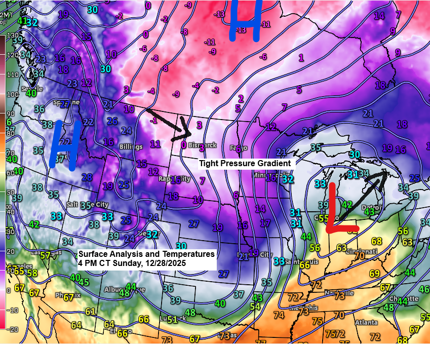
5 p.m. Weather Update – December 28, 2025
Today’s storm has unfolded pretty much as expected, with a noticeable sharp cutoff to the northern edge of the snow this afternoon. So far today, Cloverdale, Minnesota, just east of Hinckley, has seen 4 inches of snow, while Brainerd, Minnesota, has received 3 inches, and 3 inches of snow has…
-

Dry Weather Ahead for Northeast Minnesota and Northwest Wisconsin
A dry weather pattern is settling over northeast Minnesota and northwest Wisconsin for the next week, with little to no rain anticipated in the region. The Northland might see its next opportunity for rain during the middle to latter part of next week. There’s a chance of more fog tonight,…
-
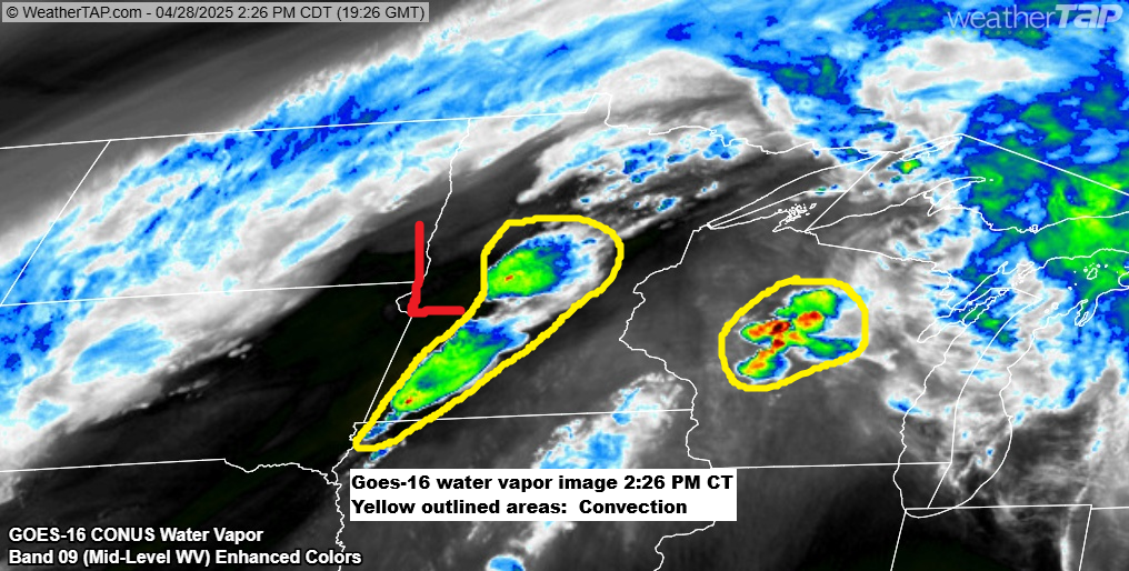
Severe Weather Update: Tornado Watch Issued for southwest Minnesota
2:46 PM Monday, April 28, 2025 A tornado watch is in effect for southwest Minnesota until 8 PM tonight, and another watch is expected by 5 PM for parts of eastern and southeast Minnesota and west central Wisconsin. Low pressure has moved into far western Minnesota early this afternoon, and…
-
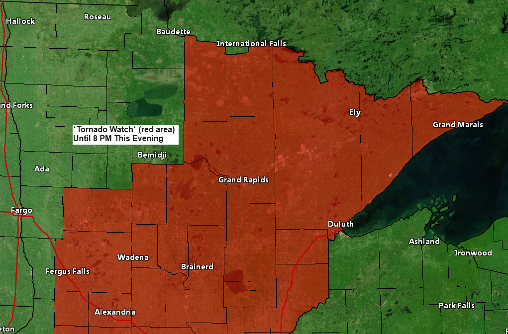
Tornado Watch issued for all of northeast MN
1:56 PM Tuesday, June 18, 2024 The Storm Prediction Center in Norman, Oklahoma, has issued a tornado watch effective until 8 PM tonight. This watch encompasses parts of Minnesota, including International Falls, Hibbing, Grand Rapids, Walker, Brainerd, Aitkin, Pine City, Hinckley, Moose Lake, Cloquet, Duluth, Two Harbors, Isabella, Silver Bay,…
-
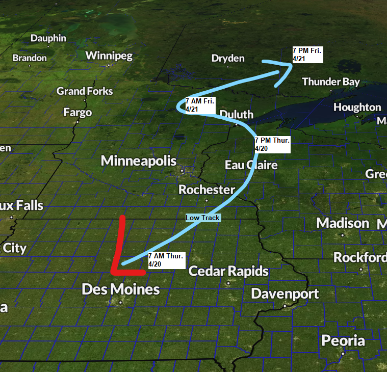
Rain, Sleet, Wet Snow, Isolated T-Storms, and some Freezing Rain on the way late tonight-Thursday night; Strong NE winds with gusts >45 mph near Lake Superior through Thursday evening — Updated Snowfall Forecast
6:24 PM Wednesday, April 19, 2023 A messy winter/spring storm will impact the Northland beginning late tonight and lingering into early Friday morning. Will there be a surprise or two with this storm? There could be, in that snow and or ice accumulations could end up higher than what is…
-

Windy and Cooler on Thursday with a few flurries; Warmer temperatures return this weekend into early next week; Lake Superior ice coverage update
5:43 PM Wednesday, February 8, 2023 A cold front will move through the Northland on Thursday bringing cooler temperatures but more importantly some gusty northerly winds. A few light snow showers or flurries are also possible on Thursday but little if any snow accumulation is expected. Temperatures on Thursday will…