Category: Duluth weather
-
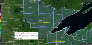
A dry weekend ahead; areas of frost possible tonight and Saturday night
Looking at a dry weekend across the Northland, but it will be on the cool side, especially near Lake Superior where daytime highs Saturday and Sunday are forecast to be in the 50s to lower 60s with easterly breezes at 5 to 15 mph with higher gusts. Farther inland from…
-
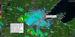
A few showers/t-storms this evening otherwise dry through the weekend; patchy frost possible Saturday morning
There is a chance for some patchy frost in parts of the Northland early Saturday morning with the greatest chances away from Lake Superior and in low lying areas – A frost advisory may be needed for parts of the Northland early Saturday morning. Source: 18z NAM 3km model 6.11.2020…
-
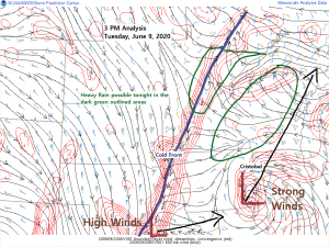
Heavy Rain possible west and east of Duluth tonight; lingering showers and blustery Wednesday
Chances for getting a heavy soaking rain in Duluth and Superior tonight have diminished considerably! -Remnants of Tropical Storm Crystobal and its associated heavy rainfall should slide mostly south/east of Duluth and Superior tonight, while additional rain develops off to the west across central into northeast Minnesota, but the heavier…
-

Remnants of Tropical Depression Cristobal to bring rain to the Northland late Tuesday-Wednesday, and possibly some snow to parts of Ontario Wednesday-Thursday
Tropical Depression Cristobal was located about 110 miles north of Monroe, Louisiana as of 4 PM Monday with movement to the north at 18 mph. Cristobal has a minimum central pressure of 994mb/29.36″ with maximum sustained winds of 35 mph. Cristobal will turn into a Post-Tropical/Extratropical system by Wednesday morning…
-
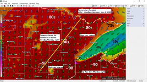
Areas of fog along with a cool breeze near Lake Superior; very warm and muggy inland (near record warmth Monday?) risk for showers/t-storms mainly over northern Minnesota through Monday night
We’ve got quite an interesting weather pattern right now, but at the same time it’s a frustrating one, especially for areas that need rain, like Duluth (-4.02″ below normal precipitation since January 1st) I’ll try to break down what’s going on now and what may happen over the next few…
-
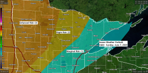
Turning warm with a tropical feel by Monday, but much cooler near Lake Superior; rounds of rain/thunder the next few days
We’ve got quite an interesting weather pattern setting up the next few days. 1: An upper level trough across the western U.S. will be moving to the ENE reaching the Northern Plains and upper Midwest. 2: Tropical Storm Cristobal heading north over the western Gulf of Mexico and likely to…
-

Shower/t-storm chances Saturday night into the middle of next week
Showers and thunderstorms are possible across the Northland beginning Saturday night, and these storm chances will continue into the middle of next week, so some much needed rain could be on the way. Note: Precipitation deficits across the Northland since January 1st range from 2 to 4 inches below normal!…