Category: Goes-16 imagery
-
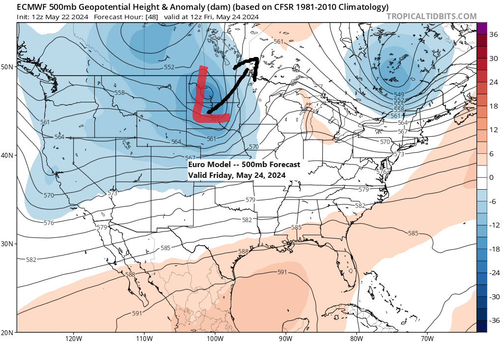
Active pattern continues
6:03 PM Wednesday, May 22, 2024 The active weather pattern is expected to persist at least into the early part of next week. A short respite from the rain and strong winds is expected on Thursday, but it will be fleeting as a new system is predicted to move northeast…
-

A few rain/snow showers Friday night; Flurries and snow showers with colder temperatures this weekend
5:05 PM Thursday, March 14, 2024 Active weather occurring again today well south of the Northland with a winter storm ongoing in parts of Colorado with reports of a foot or more of snow, including a report of nearly 10 inches of snow near Denver. And we’re also seeing more…
-

Remnants of Tropical Depression Cristobal to bring rain to the Northland late Tuesday-Wednesday, and possibly some snow to parts of Ontario Wednesday-Thursday
Tropical Depression Cristobal was located about 110 miles north of Monroe, Louisiana as of 4 PM Monday with movement to the north at 18 mph. Cristobal has a minimum central pressure of 994mb/29.36″ with maximum sustained winds of 35 mph. Cristobal will turn into a Post-Tropical/Extratropical system by Wednesday morning…
-
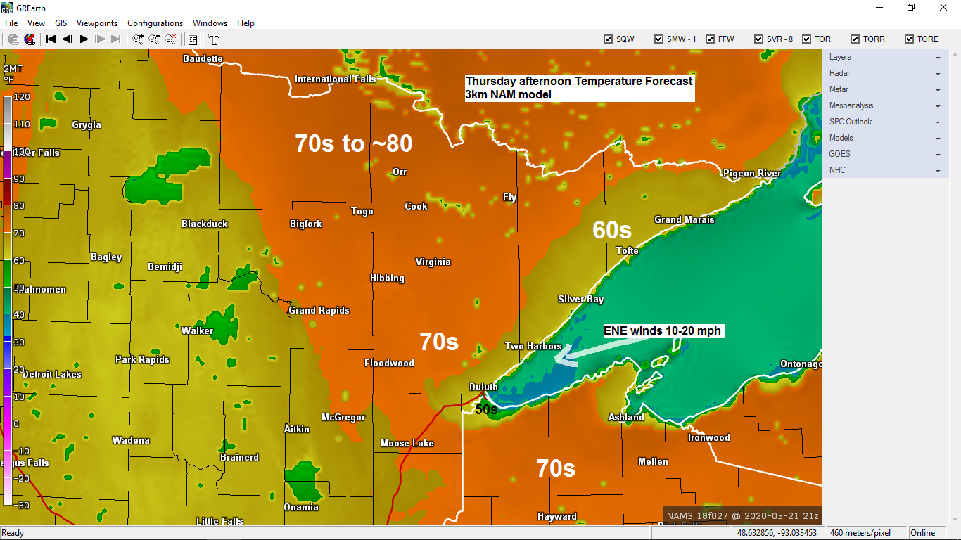
Dry Thursday; scattered showers possible late Friday through Sunday
It’s official! Duluth, Minnesota recorded their first 70 degree or warmer temperature of 2020 today, May 20 with a high of 72 degrees at the Airport. The last time Duluth had a temperature of 70 degrees or warmer was on October 9, 2019 when the high was 72 degrees. Note:…
-
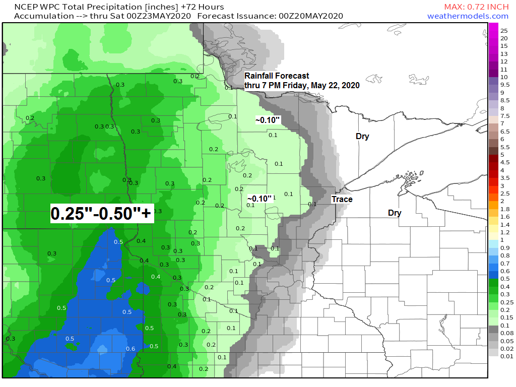
Dry through Thursday; few showers possible this weekend
A little more moisture in the form of higher dew points will be moving into the Northland over the next few days with dew points in the 40s and 50s, this may eventually lead to some fog/low clouds at times near Lake Superior beginning Wednesday evening, and possibly continuing into…
-
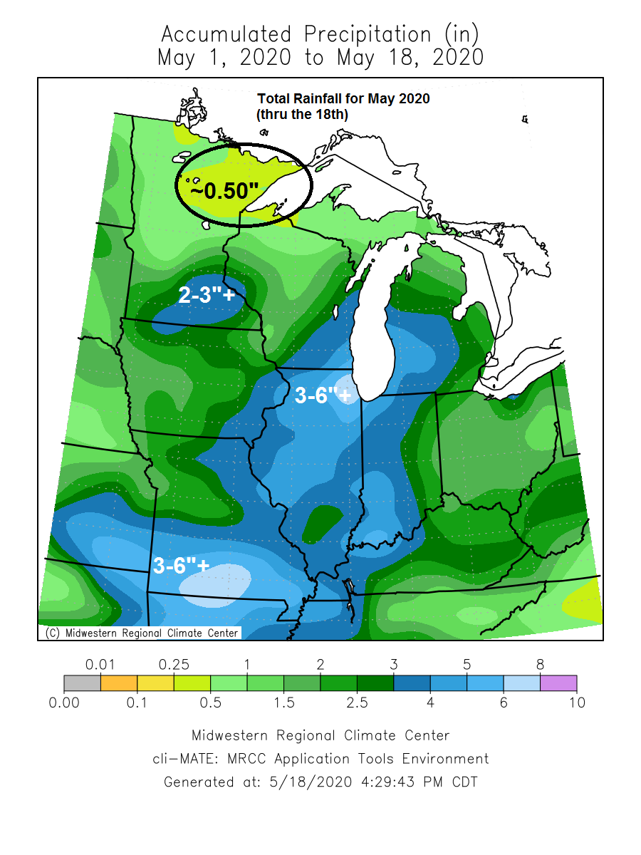
Dry pattern continues across the Northland! Warm inland while cool breezes linger near Lake Superior
Dry weather continues across the Northland for the next few days. Warmest temperatures will be found inland from Lake Superior by some 10 to 20 miles. Daytime highs for inland locations will be in the 60s and 70s Tuesday, Wednesday and Thursday with easterly winds 5 to 15 mph with…
-
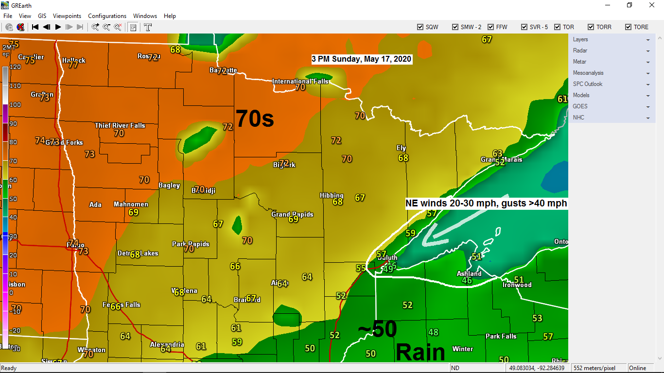
Hudson Bay High keeps it windy, cool, and dry near Lake Superior through midweek; warmer temps inland
Howling winds will continue near Lake Superior the next few days with a stiff northeast wind 15 to 30 mph (gusting to around 40 mph) the wind will kick up some dust at times. Temperatures near Lake Superior won’t vary much through Wednesday with daytime highs of 45 to 55…