Category: photography
-
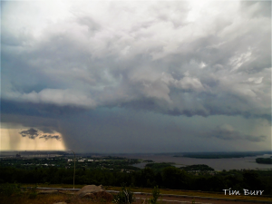
Storm Reports from today, July 5, 2020; And a look ahead to Monday’s weather which includes more chances for storms
It’s been a bit stormy in parts of northeast Minnesota and northwest Wisconsin today, with one area that has had a few rounds of strong and severe thunderstorms being near Lake Superior. Here’s how today’s storms looked on Goes-16 Sandwich Satellite imagery, this loop goes from around Noon to 6…
-
Warm and muggy this week (cooler lakeside through Wednesday) Showers/t-storms possible at times over the next few days
Scattered showers and thunderstorms are possible at times over northeast Minnesota and northwest Wisconsin from tonight through the middle of the week. Severe thunderstorm chances are on the low side, however, due to weak winds aloft and generally weak shear, but there will be ample amounts of instability and moisture…
-
Storm Reports from around the Northland
Local Storm Reports from Sunday, June 21, 2020 Source: https://www.weather.gov/dlh/ 4:40 PM: THUNDERSTORM WIND DAMAGE. 4 NNW Butternut, WI (Ashland County) Trees down along Neuberger RD and Highway 13. 4:40 PM: THUNDERSTORM WIND DAMAGE. 4 NNW Butternut, WI (Ashland County) A dozen or more healthy trees down between Griffith RD…
-

Cold tonight; little milder Thursday and Friday; 50s return Saturday
…Record Cold in the Northland on April 14, 2020… *Brainerd Minnesota – Record low high temperature of 27 degrees, the previous record was 31 degrees set in 2018. *Hibbing, Minnesota – Record low high temperature of 26 degrees, the previous record was 30 degrees set in 2018. *Ashland, Wisconsin –…
-

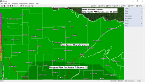
Scattered showers/few t-storms late tonight and Tuesday AM; breezy and mild with some sun Tuesday afternoon
*Marginal risk of severe thunderstorms for portions of west-central Minnesota, southeast North Dakota and northeast South Dakota for tonight (dark green area on map) Note: This risk area extends into western portions of the Northland, including the Walker, Pine River and Brainerd areas. The main threat is from hail, possibly…
-
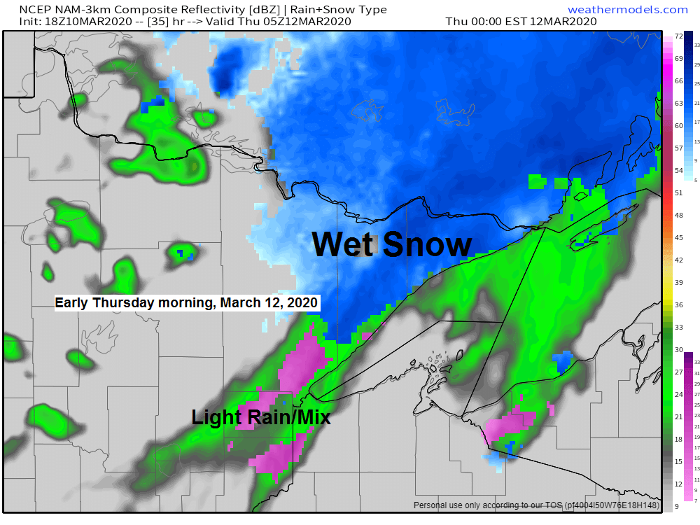
Mild temps the next few days; turning a little cooler late this week; a few light precip events through next week
A little rain, a little wet snow on the way Wednesday night and Thursday. Time to panic, buy some more TP! This pattern is great if you like the occasional light precipitation event in northeast Minnesota and northwest Wisconsin. I don’t see any changes in this pattern through next week,…
-
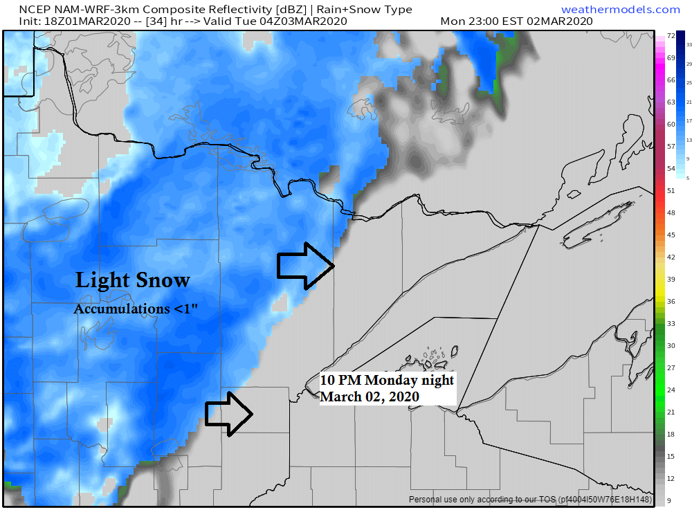
Mild week ahead; little snow possible Monday night-early Tuesday; and again Wednesday night-Thursday
A strong low pressure system is passing north of Minnesota today as it moves across Saskatchewan and into Ontario, but the southern portion of this system is clipping the extreme northern part of Minnesota where some light snow has been reported this afternoon in the Warroad and Baudette areas. Source:…