Category: precip stats
-
Duluth Weather Report 2025: Temperature & Precipitation Trends
2025 Climate Overview for Duluth, Minnesota. Average temperature: 40.5 degreesMean: 40.6 degrees Departure: -0.1 degrees below average Note: 2025 ended up being 4.1 degrees colder than 2024. Coldest month: January, with an average temperature of 9.0 degrees. Warmest month: July, with an average temperature of 66.5 degrees. Lowest temperature: -27…
-

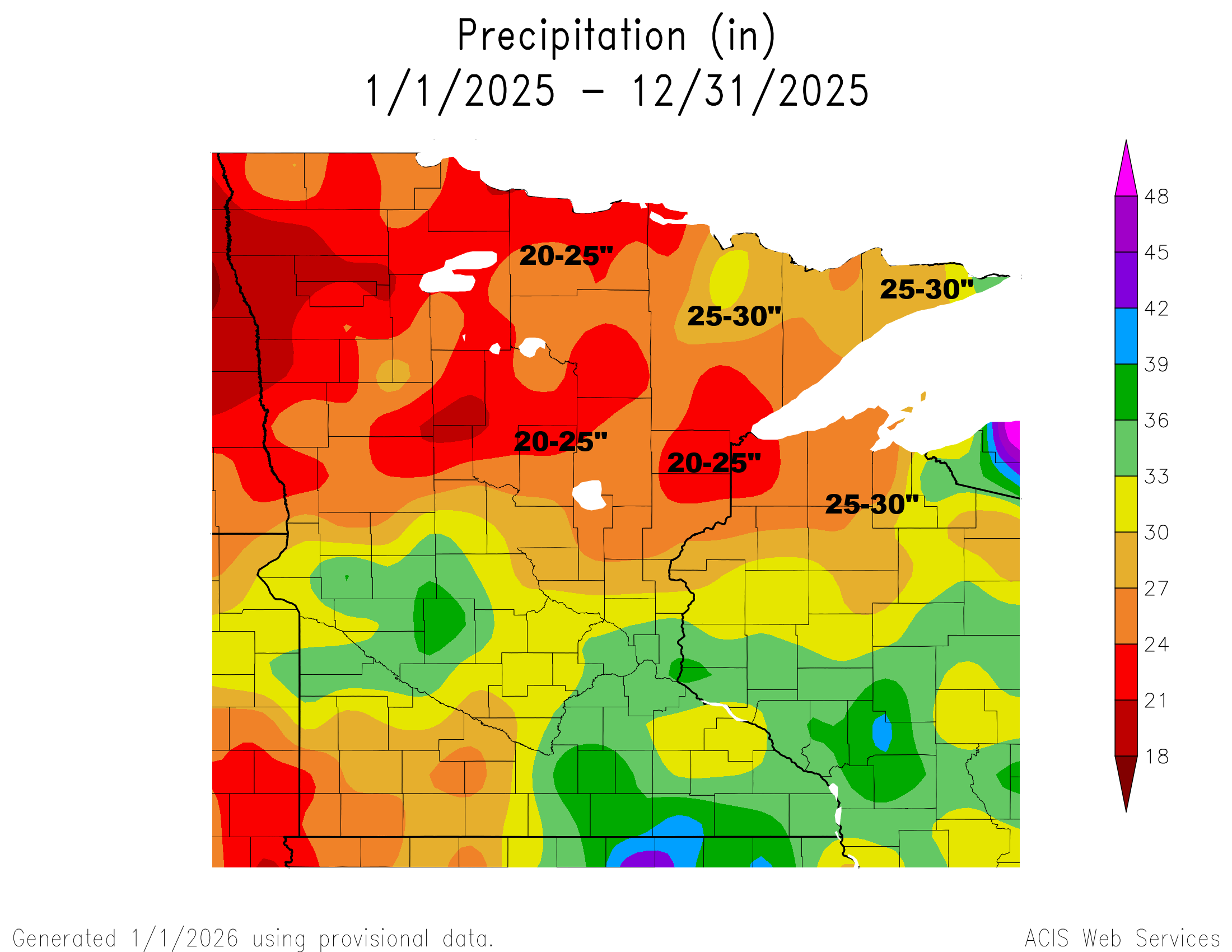
Top 10 Driest Years for Duluth, MN
2025 could turn out to be one of the top 10 driest years on record for Duluth, Minnesota. As of December 25th, 20.09 inches of precipitation have fallen this year, which is 10.83 inches less than the normal total of 27.33 inches. The ten driest years on record in Duluth,…
-

Rain and snow are possible next Tuesday and Wednesday.
After the rainfall last night and today, November 2025 in Duluth won’t end up as the driest on record. That honor still goes to 1917 and 1916, when just 0.09 inches of precipitation fell. So far this month, through the 20th, Duluth has received 0.11 inches of precipitation. Duluth saw…
-
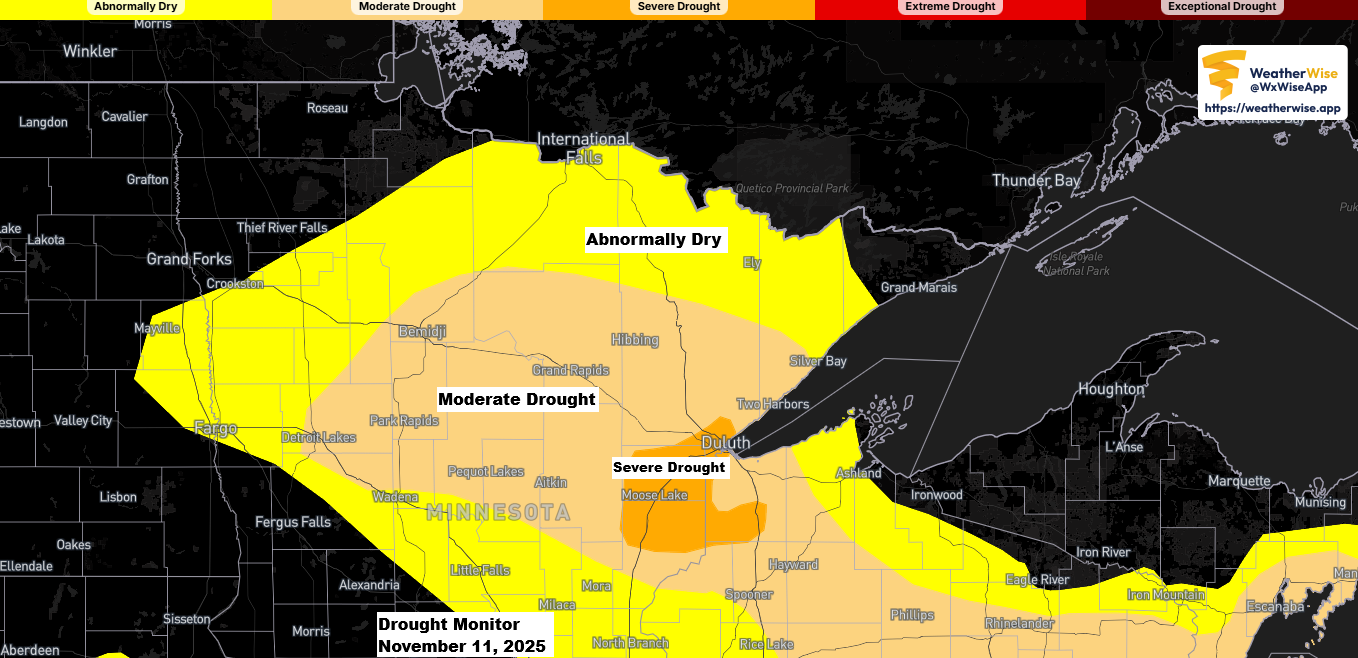
Current Drought Conditions in Minnesota and Wisconsin
It’s no surprise that a small patch of severe drought showed up in last week’s drought monitor update, and it’s still there in this week’s report. It covers about 2% of Minnesota, stretching from Duluth through Cloquet, Moose Lake, and Sandstone, and extends into a sliver of northwest Wisconsin—around 1%…
-

Weather Update: Dry Fall Continues in Northeast Minnesota and Northwest Wisconsin
No major weather systems are expected to affect northeast Minnesota or northwest Wisconsin for at least the next 7 days, continuing the dry fall. Since September 1st, Duluth has seen 4.06 inches less precipitation than usual, with a total year-to-date deficit of over 10 inches at -10.14 inches. Northwest Wisconsin…
-
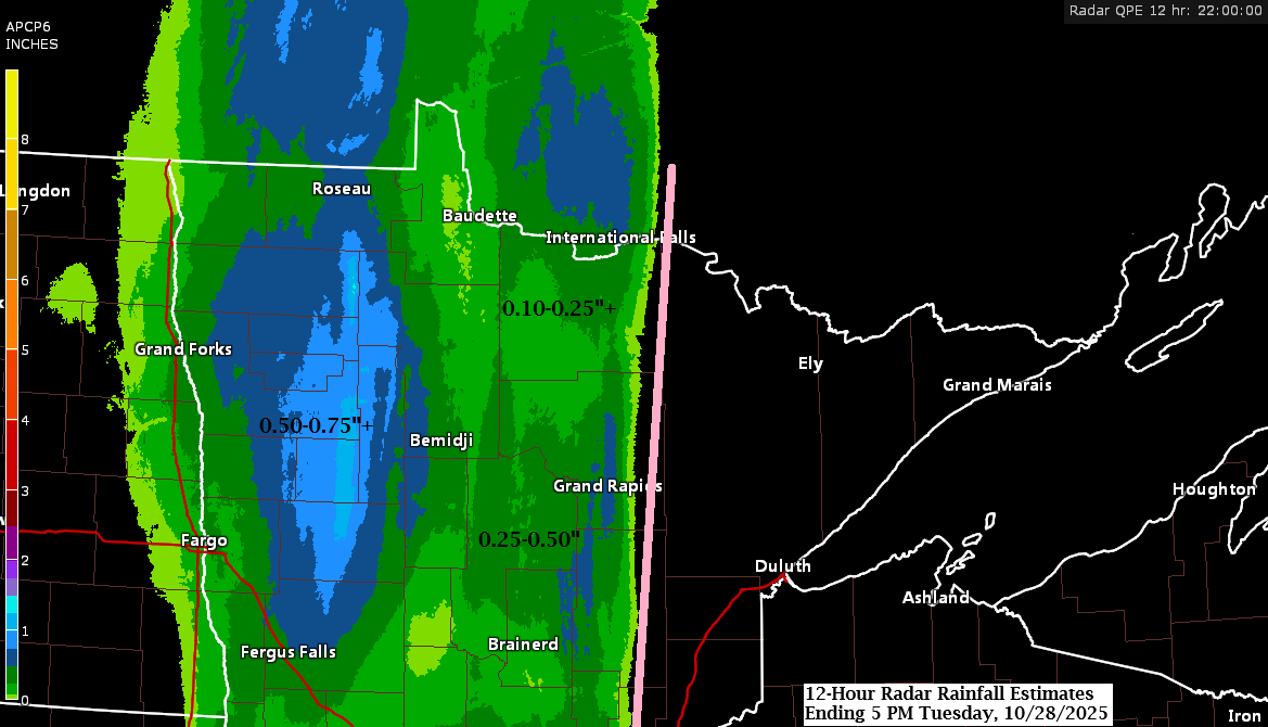
Northland Weather Update: Rainfall and Anomalies in October 2025
Western parts of the Northland experienced a rainy day, with rainfall amounts ranging from about 0.20 inches to over half an inch west of the line from International Falls to Aitkin. However, areas east of that corridor stayed dry with no rain reported today. Rainfall data from Monday night through…
-

Monday will stay dry, but rain chances increase on Tuesday, with the greatest likelihood in the western and far southern regions.
In the next few days, a strong trough will move into the northern Plains, while a ridge stays over the Great Lakes and eastern Canada. This ridge will push the trough southeast, keeping most of the rain away from northeast Minnesota and northwest Wisconsin on Tuesday. However, areas in the…