Category: record highs
-
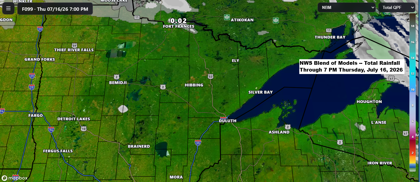
Minimal Lake Relief This Week as Fires Continue in Far Northern St. Louis County
Hot, dry weather will linger across the Northland for most of the week, with only a slight chance of cooler conditions near Lake Superior by mid to late week. Any relief from the lake will likely be minimal, as the water has warmed with mid-July’s arrival. …New record High Temperatures…
-
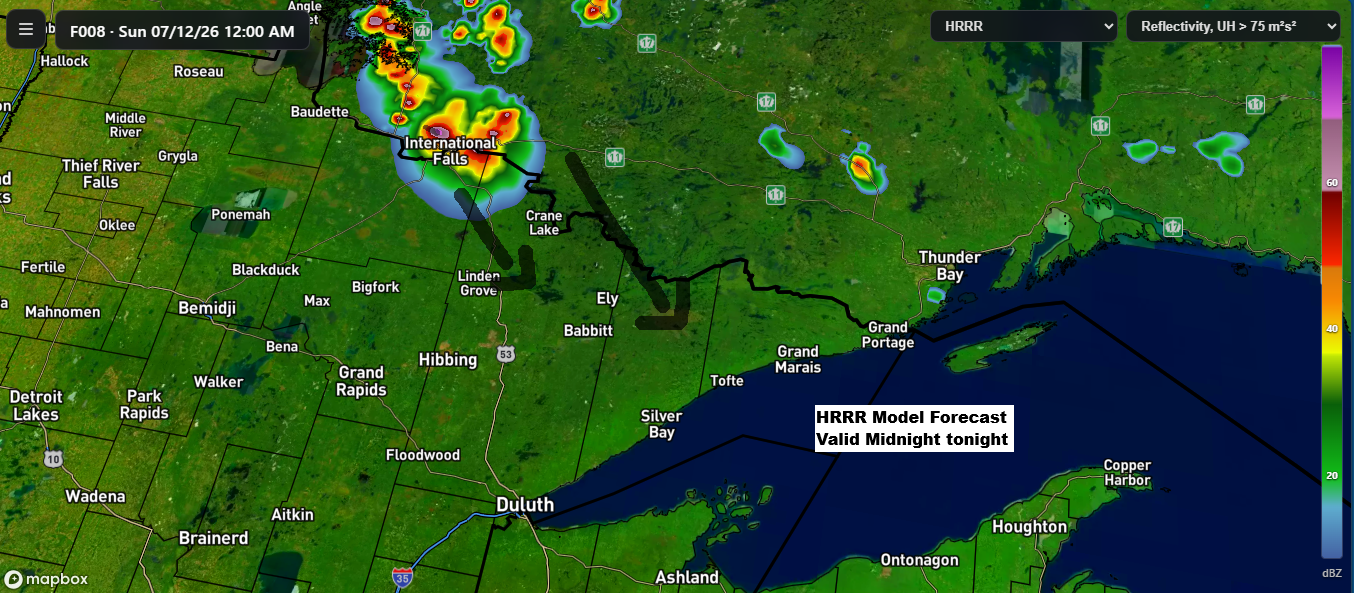
Low Overnight Storm Chances Tonight, Then a Remarkable 597–600 dam Ridge Builds Into the Northland Early Next Week
While chances are low, some model runs today suggest showers and thunderstorms could form over far northern Minnesota or southern Ontario tonight. If they do develop, they’d likely track southeast early Sunday morning. There’s plenty of instability and moisture in the air to support storms but rising heights from a…
-
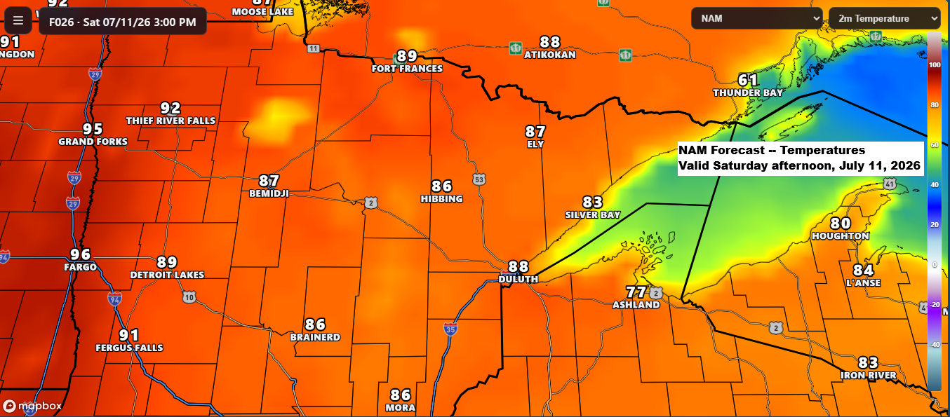
Major Heat Wave Builds Sunday–Monday, With International Falls Possibly Nearing 100° for the First Time Since 1923
According to the data I’ve seen, the last time International Falls, Minnesota reached at least 100 degrees was July 22, 1923. Now, there’s a chance it could get close to 100 degrees again this Sunday and Monday. High temperatures are expected to be in the 80s to low 90s on…
-
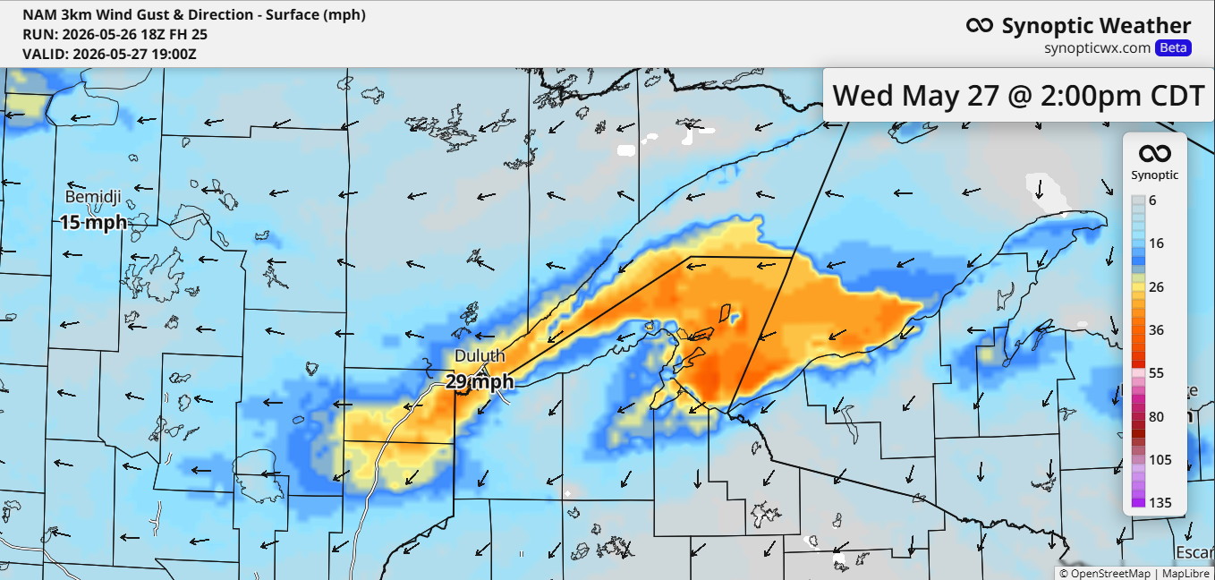
Evening Storms South, Chilly Lakeshore Winds Wednesday
This afternoon, scattered showers and thunderstorms rolled through the southern parts of the Northland, driven by warm, humid, unstable air. With light winds near the surface and weak winds higher up, the storms have been short-lived—forming, building up, and fading within about an hour. A few hit severe levels, bringing…
-
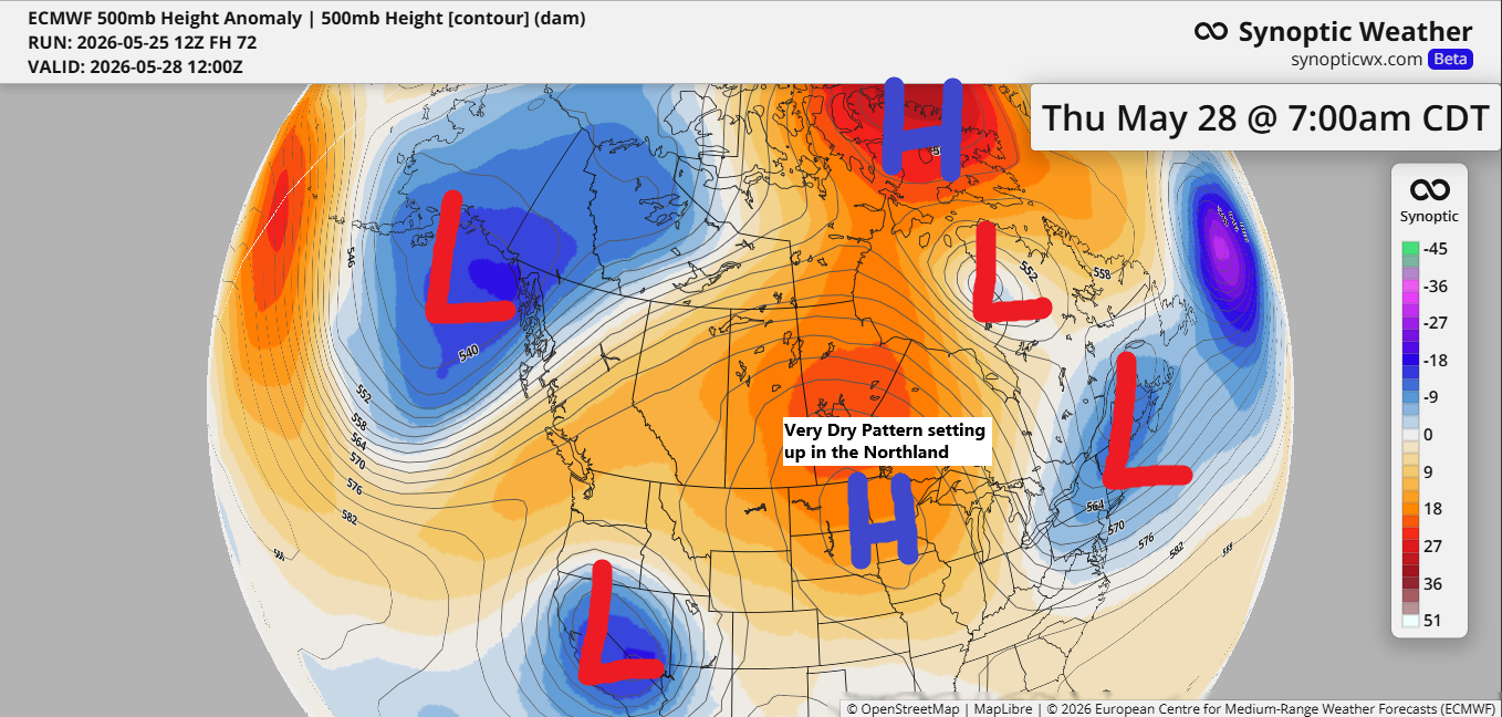
Weather Update: Dry Days Ahead for Northeast Minnesota and Northwest Wisconsin
The upcoming weather pattern looks very blocky and amplified, meaning day-to-day changes will be minimal. Northeast Minnesota and northwest Wisconsin appear to be in the dry zone after tonight, with little to no rain expected at least through early next week. A cold front is moving south across the Northland…
-

Warmth spreads across the Northland, accompanied by a few isolated showers and thunderstorms.
A mid and upper-level trough lingered over the upper Midwest into central Canada today, with the flow aloft coming from the WNW. It’s a bit of a “dirty” NW flow, meaning it doesn’t take much to spark a few showers or thunderstorms if there’s enough instability and moisture—both of which…