Tag: northland
-
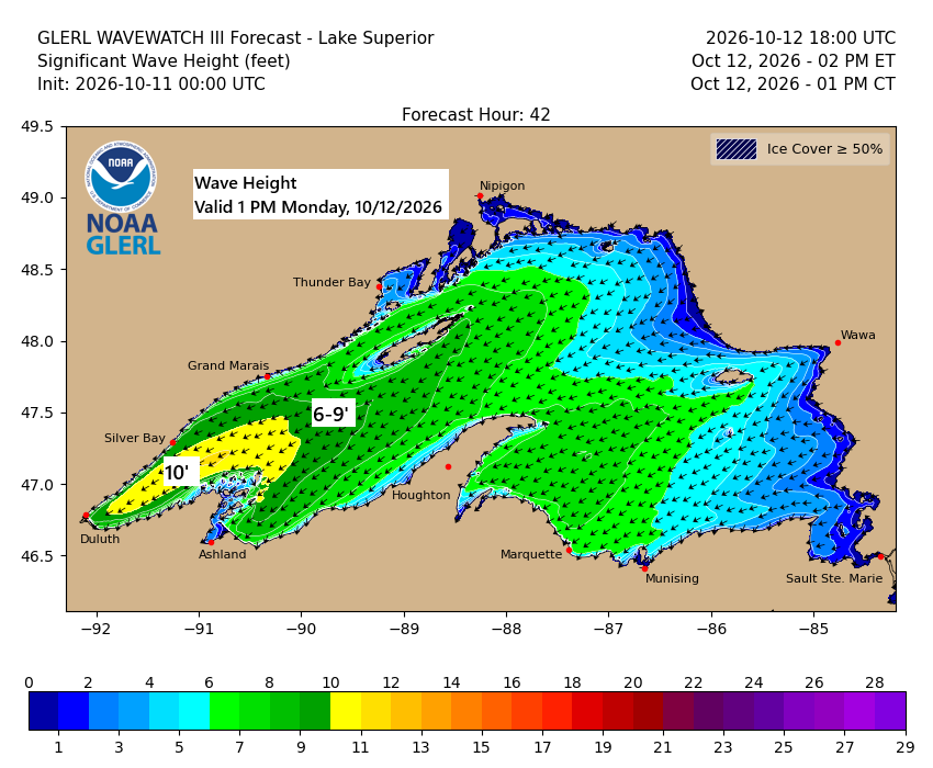
💨🌊🌧️Lake Superior Kicks Up: 45 MPH Gusts and 10-Foot Waves Possible
…Gales on western Lake Superior Monday… East to northeast winds will pick up over western Lake Superior on Monday, with gusts hitting 25 to 45 mph. Waves are expected to build to 5 to 10 feet, with the biggest swells likely from late morning through mid-evening. In Duluth, northeast winds…
-
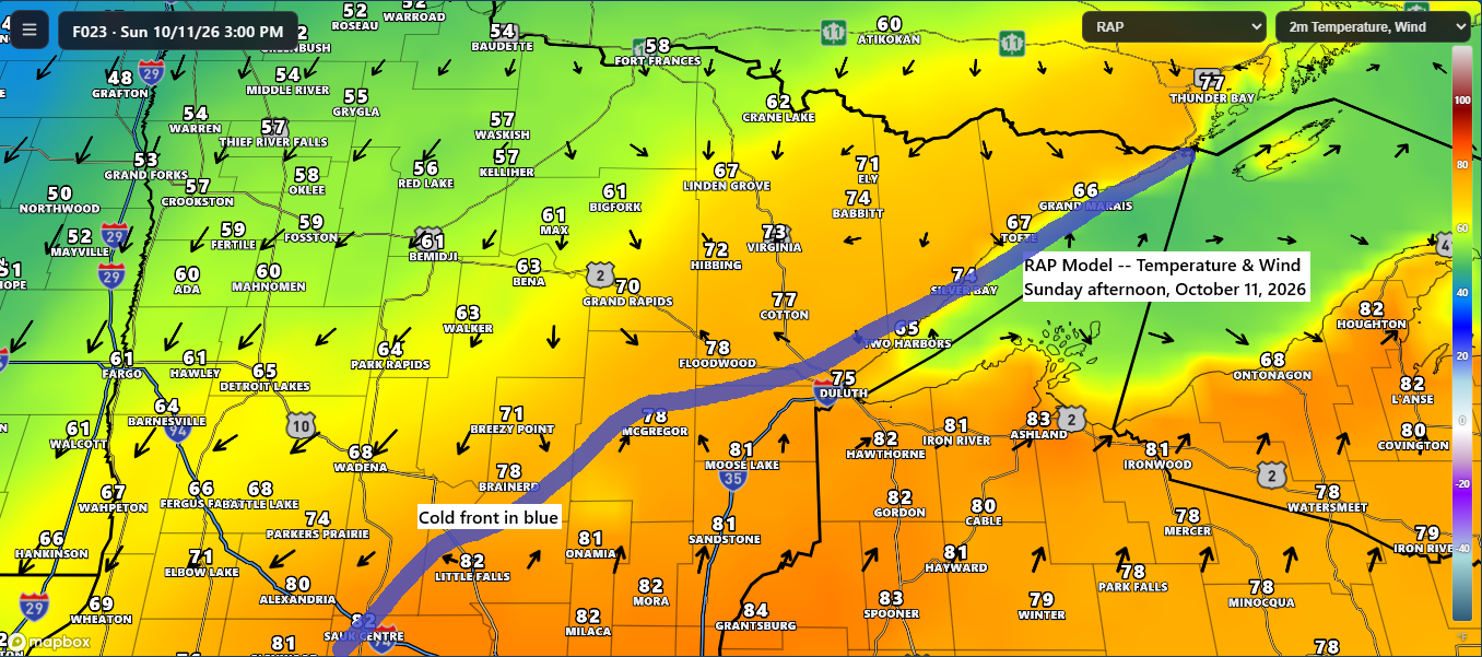
🌡️💨 Near-Record Warmth Sunday Before a Windy, Much Cooler Monday
Sunday promises another warm day with the potential for more record highs. Temperatures in northeast Minnesota and northwest Wisconsin will range from the 70s to low-to-mid 80s, while northern Minnesota will cool down behind a cold front, with highs in the 50s and 60s. Record Highs for October 11 International…
-
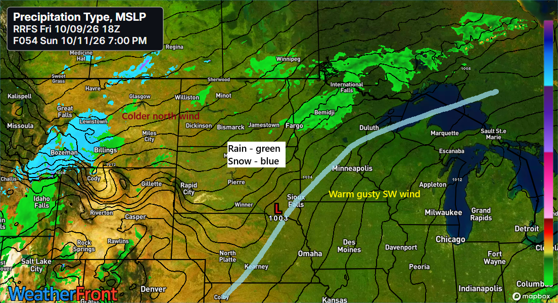
🌡️⬆️❄️🏔️Near-Record Warmth This Weekend; Snow Falls in Parts of the Rockies
Near-record warmth is expected this weekend in northeast Minnesota and northwest Wisconsin. The following are the record high temperatures that could be challenged in the coming days. October 10 Ashland, WI: 86 set in 1938Brainerd, MN: 85 set in 1928Duluth, MN: 82 set in 1938Hibbing, MN: 81 set in 1938International…
-

🌬️🌦️Chilly Air Aloft Could Spark Spotty Showers Wednesday
The next few days will be slightly cooler, but nothing too chilly, with highs ranging from the mid-50s to mid-60s across the area—pretty typical for early October. Cooler air aloft, with 500mb temperatures between -20 and -25°C, will move over the Northland on Wednesday. Combined with warmer surface conditions, this…
-
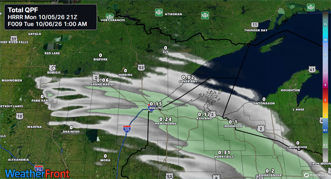
🌧️⚡🌡️Scattered Showers and an Isolated Storm Tonight; Summer-Like Warmth This Weekend
A burst of warm air and moisture, along with a southwesterly low-level jet picking up to about 30-40 knots and a warm front pushing east from western Minnesota, will bring scattered showers to parts of northeast and east-central Minnesota and northwest Wisconsin for a few hours tonight, with the best…
-
🌡️ Freeze for Some, Not All: Lake Superior Keeps Shoreline Areas Milder
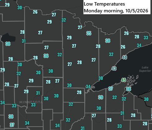
Much of the Northland experienced freezing or near-freezing temperatures early Monday morning, with lows ranging from 26 to 34 degrees. As is often the case, areas near Lake Superior remained milder, with temperatures bottoming out in the upper 30s to lower 40s. On Monday morning, October 5, the official low…
-
🌡️Big Changes Ahead: Freeze Alerts Now, Warm Surge Next Weekend
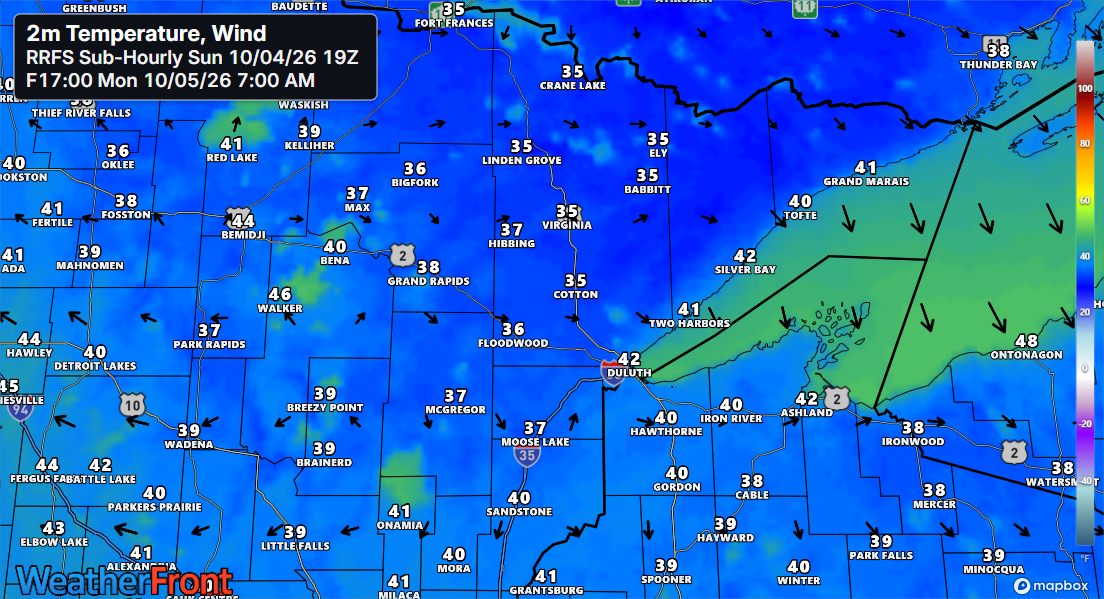
Freeze and frost alerts are in effect for early Monday morning across northeast Minnesota and northwest Wisconsin. Temperatures are expected to drop into the upper 20s to around 30 degrees in areas under the freeze warning, while those under the frost advisory will see lows in the low to mid-30s.…