Tag: temperatures
-

Weekend weather for the Northland: Expect occasional rain with a few thunderstorms in the mix.
Dry weather will stick around in the Northland tonight and through most of Saturday, but the chance for occasional rain will increase later in the day and continue into Sunday night. This rain will be caused by a northward-lifting warm front, which is forecast to be over southern Kansas around…
-
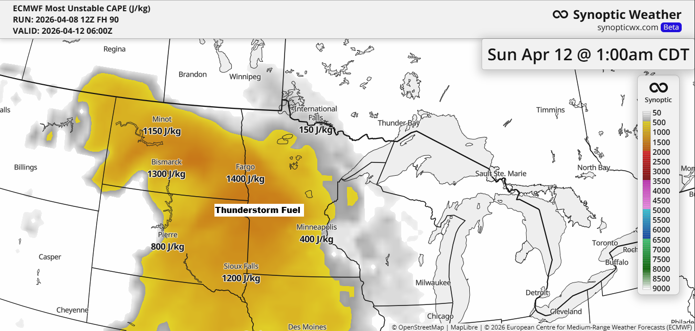
Breezy with scattered rain/snow showers tonight; weekend rain chances on the way
Thunderstorms are likely to move into the Northland this weekend, especially from Saturday night into Sunday. Elevated CAPE, indicating instability, is expected to increase from southwest to northeast, with moisture pushing north. Paired with a low-pressure system and its warm and cold fronts providing lift, this setup will bring occasional…
-
Quiet but Chilly Tonight; Active Days Coming Up
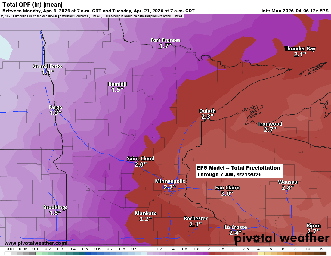
After a short break from the active weather pattern, it appears set to return over the next two weeks, with multiple systems potentially impacting the Northland and bringing a chance for significant precipitation. Ensemble models are predicting over 2 inches of precipitation in northeast Minnesota and northwest Wisconsin through April…
-
Temperatures will drop over the next few days, with a chance of precipitation by midweek.
Colder air is set to move into the Northland on Monday, with highs mostly in the 20s to around 30 degrees and blustery north to northwest winds. A few flurries and snow showers are likely tonight into Monday morning, but any accumulation should be minimal for spots that see some…
-
Snow will linger this evening, with scattered snow and rain showers on Sunday afternoon, followed by cold temperatures on Monday and Tuesday.
Snow will continue in the Northland this evening on the backside of the mid and upper-level low, but it will taper off from west to east later tonight as the system moves away. With the strong April sun angle fading late this afternoon, we could see some slushy accumulation on…
-
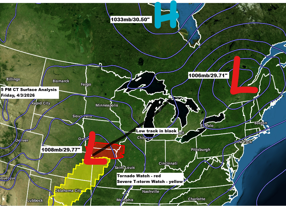
Winter Storm Update – Friday, April 3, 2026, 6:00 PM
Another winter storm is set to impact the Northland through Saturday. Much like Thursday’s storm, it will bring a mix of snow, sleet, and freezing rain. Freezing rain is most likely in northwest Wisconsin and far eastern Minnesota, with the chance for significant icing from late tonight through mid-morning Saturday.…
-
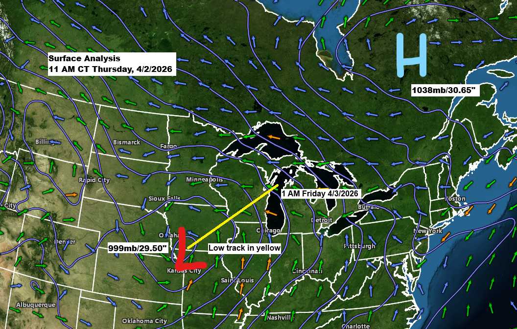
Winter Storm Update – 12:00 PM, Thursday, April 2, 2026
A low pressure system of about 999mb/29.50 inches is positioned over far southwest Iowa and will move northeast, passing near Green Bay, Wisconsin by tonight. To the northeast, there is a strong arctic high of 1038mb/30.65 inches located over Quebec, Canada, which is sending colder air into the Northland with…