Tag: thunderstorms
-
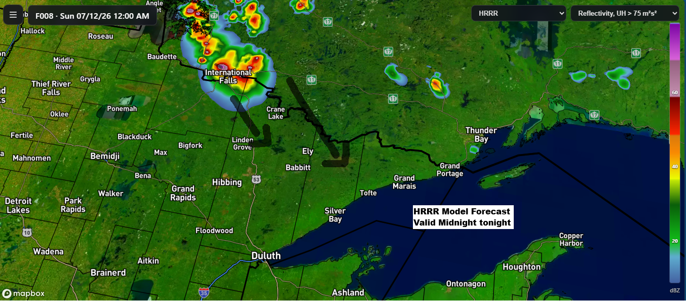
Low Overnight Storm Chances Tonight, Then a Remarkable 597–600 dam Ridge Builds Into the Northland Early Next Week
While chances are low, some model runs today suggest showers and thunderstorms could form over far northern Minnesota or southern Ontario tonight. If they do develop, they’d likely track southeast early Sunday morning. There’s plenty of instability and moisture in the air to support storms but rising heights from a…
-
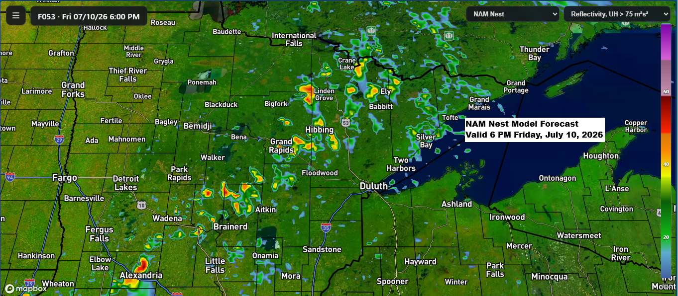
Northland Forecast: Storm Chances Friday, Then Intense Heat Builds
A northwest flow aloft, paired with some lingering moisture and instability over the Northland, along with a boundary moving in from the northwest, looks like it could spark a few showers and thunderstorms Friday afternoon into the evening. While severe weather doesn’t seem likely right now, that could change in…
-

Weekend Northland Weather: Storm Chances, Low Clouds and Fog
One of the big unknowns about the weather through Saturday is just how much rain we’ll see in the Northland. And today, the computer models still don’t align very well. As has been the trend for the past few days, the Euro forecast remains much drier, especially around Lake Superior…
-
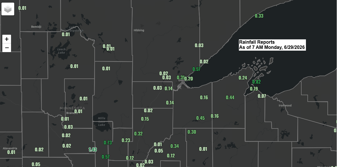
Overnight Northland Thunderstorms, Rain Totals & Evening Risk
Overnight and early this morning, scattered downpours and thunderstorms swept through parts of northeast Minnesota and northwest Wisconsin before moving out over Lake Superior and northern Lake Michigan. Some of those storms had cloud tops reaching around 50,000 feet, which is pretty impressive for this time of day. With elevated…
-

Plains Storm Line May Race Into the Northland Monday, Bringing an Isolated Wind and Hail Risk
New trends are starting to emerge in the model guidance from Sunday evening for Monday. There’s a chance a line of thunderstorms could form over western Nebraska or western South Dakota overnight, then race northeast, possibly impacting parts of north-central and northeast Minnesota from mid to late Monday morning into…
-
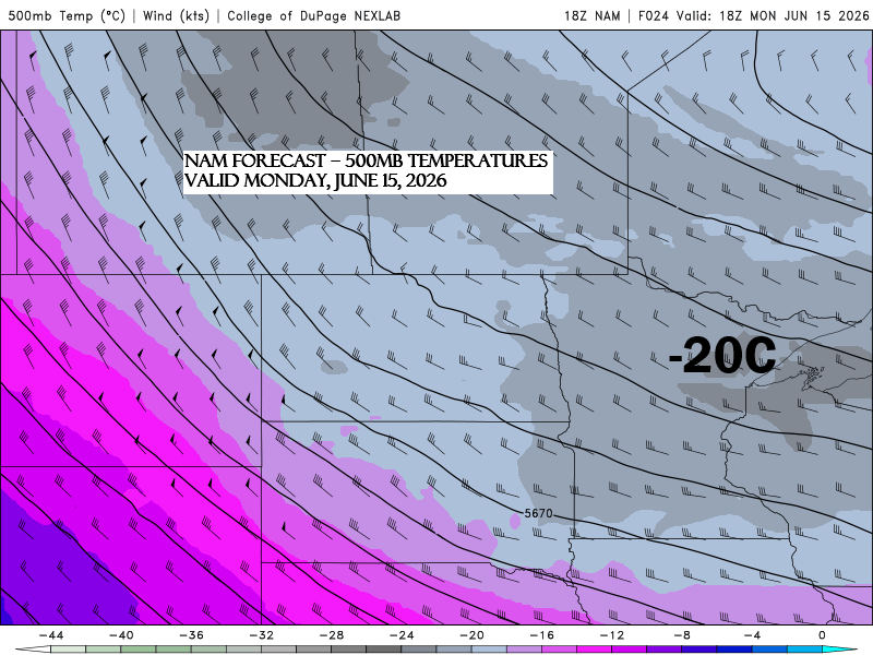
Friday Brings Scattered Showers and Thunder Chances to the Northland
Another system will move east-southeast out of the northern Plains on Friday, bringing a fresh round of scattered showers and a few thunderstorms to northeast Minnesota and northwest Wisconsin from Friday into the evening. With 500mb temperatures dipping to about -20°C, enough low-level moisture with dew points in the 50s,…
-
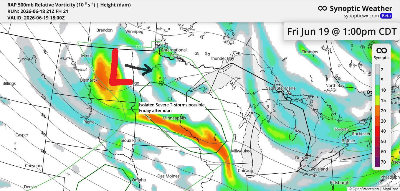
Mid‑June Shake‑Up: Storms Monday, a Four‑Day Wind Run, and a Strong Midweek System
Cold air aloft and warmer surface air, along with a NW flow aloft and a surface trough, will likely lead to scattered showers and a few thunderstorms in the Northland on Monday. Sufficient CAPE and steep mid-level lapse rates may support some storms, particularly in the afternoon to early evening,…