Tag: wildfire smoke
-

🌤️ Mostly Dry Stretch Continues; Saturday’s System Splits North and South
The next few days in northeast Minnesota and northwest Wisconsin are expected to be mostly dry, with only a few isolated showers. On Saturday, a more organized low-pressure system is expected to move east from the northern Plains, but it appears to be arriving in two waves. The main wave…
-

🌦️ Wet North, Dry South Over the Past Three Weeks; Saturday Brings Only Modest Rain
Over the past three weeks, far northern Minnesota has experienced a shift to a wetter pattern, with several rain events resulting in precipitation ranging from 100% to nearly 200% of normal since July 21. In contrast, southern areas have remained much drier during the same period, receiving only 2% to…
-

⚡🌩️ Strong Storms Stay South Tonight; 🌫️ Hazy Skies Continue; 🌧️ Saturday Shows Rain Potential
Strong to severe thunderstorms could pop up tonight well south of the Northland, impacting parts of South Dakota, Iowa, and possibly southern Minnesota. The main threat is damaging winds between 60 and 75 mph, with hail up to 2 inches in diameter possible, especially in parts of South Dakota. Any…
-
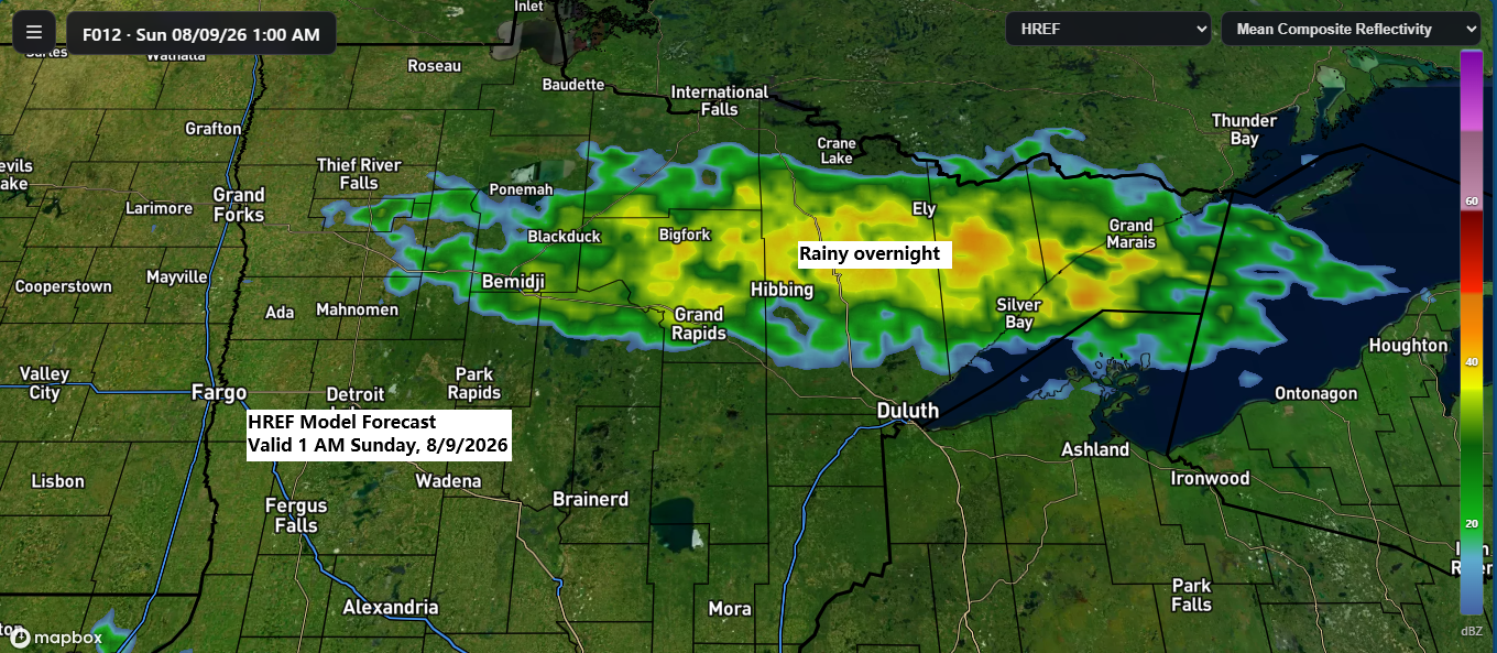
🌧️ Showers Tonight; Sunday Turns Dry After Mid‑Morning
Rain is likely tonight into early Sunday morning in parts of the Northland as a frontal boundary drifts southeast through the region. With limited instability, a few isolated thunderstorms are possible but expect mostly rain showers and little thunderstorm activity. The rain should clear out to the east by mid-morning…
-

🌫️ Hazy Skies Saturday From Wildfire Smoke; Saturday Night Rain Mainly North
Wildfire smoke is expected to drift into the Northland on Saturday, but most of it will remain high in the atmosphere, causing hazy skies with minimal impact at ground level. Below is the HRRR model forecast for vertically integrated smoke. Saturday morning looks clear across the Northland, with the next…
-
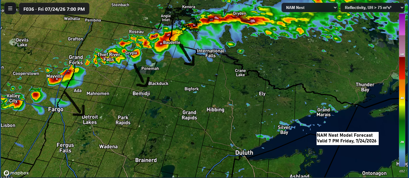
Storm Risk Friday, Then High‑Altitude Smoke Brings Haze Into the Weekend
A few strong to severe thunderstorms could develop from late Friday afternoon into the evening, mainly across parts of the eastern Dakotas into west-central and northern Minnesota. This is where conditions may come together to support the risk for some severe storms. Late Friday afternoon and evening, the main severe…
-
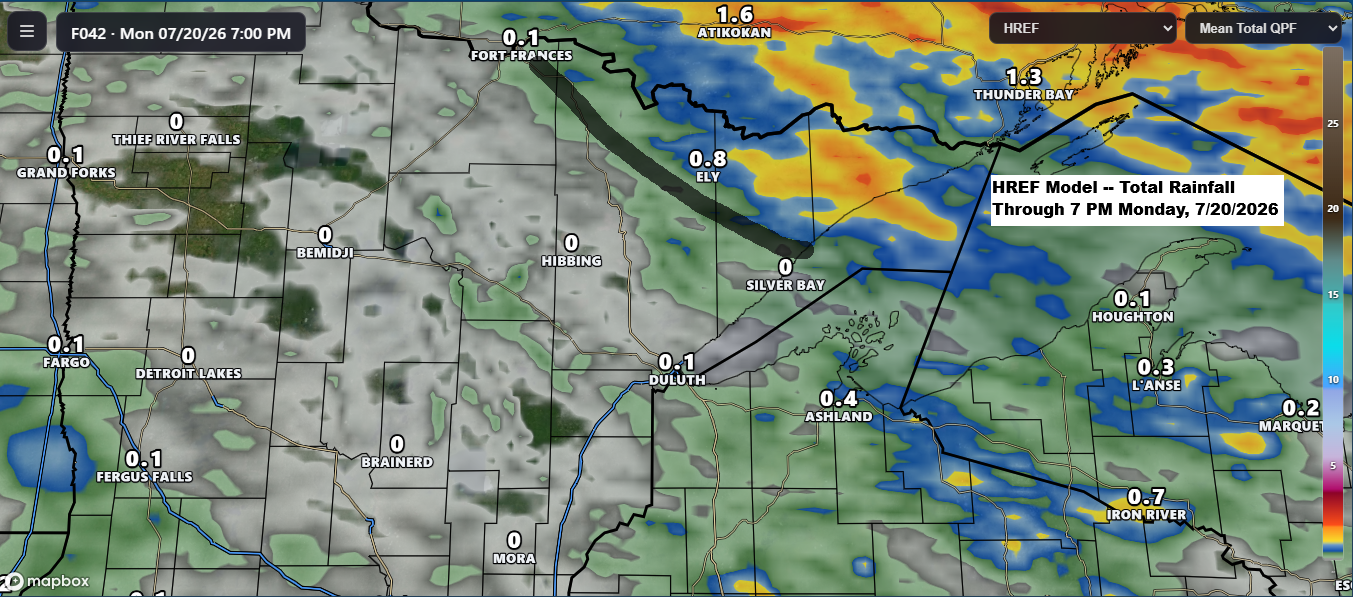
A warm Sunday is in store across the Northland before scattered showers arrive tonight and continue into Monday.
Scattered rain is on the way for the Northland as a strong low-pressure system moves east today from Saskatchewan and into Ontario by Monday. A warm front and cold front tied to this system will sweep through the Northland on Monday. Ahead of this system, south winds will draw moisture…