Tag: dew points
-
Northland Severe Storms Tonight: Large Hail, Damaging Wind Risk
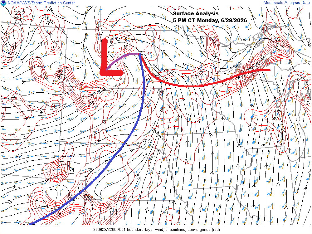
This afternoon, a low-pressure system over central North Dakota has a warm front stretching east-southeast through central Minnesota into northern Wisconsin, while a cold front extends southwest from the low across the eastern Dakotas. South of the warm front, temperatures climbed into the upper 80s and low 90s today, while…
-

Severe Thunderstorm Watch for Central & Northern Minnesota Today
This morning, a small but intense supercell and bow echo raced northeast from southern South Dakota into west-central Minnesota. As a result, a severe thunderstorm watch is in effect downstream of the storm until 4 PM today, covering northern and central Minnesota (highlighted in yellow on the map). The main…
-
Northland Forecast: Muggy Monday, Storm Chances & Late‑June Snow Out West
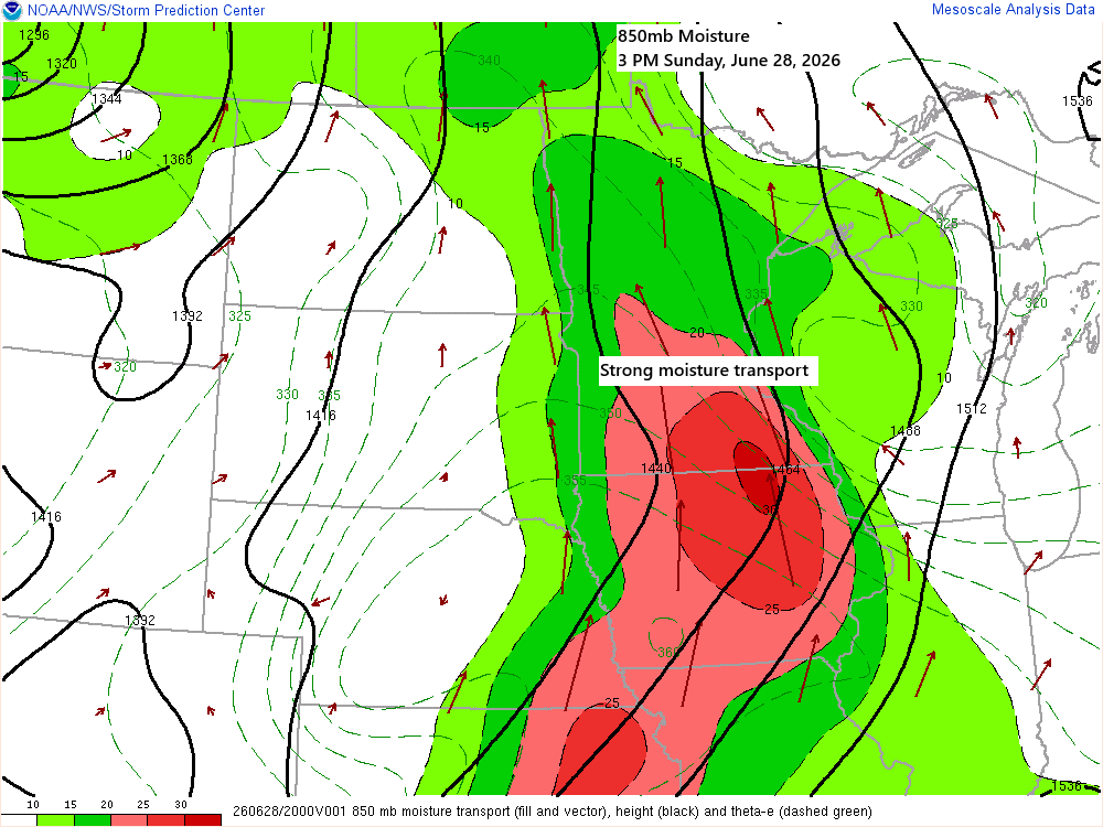
A strong southerly low-level jet will keep pushing plenty of moisture north into our area tonight. This afternoon’s surface map shows two boundaries: one behaving more like a moisture gradient front, with dew points climbing into the 70s to the south and sitting in the 50s and low 60s to…
-
Heat Pushes North as Midwest Ridge Strengthens Ahead of the Holiday
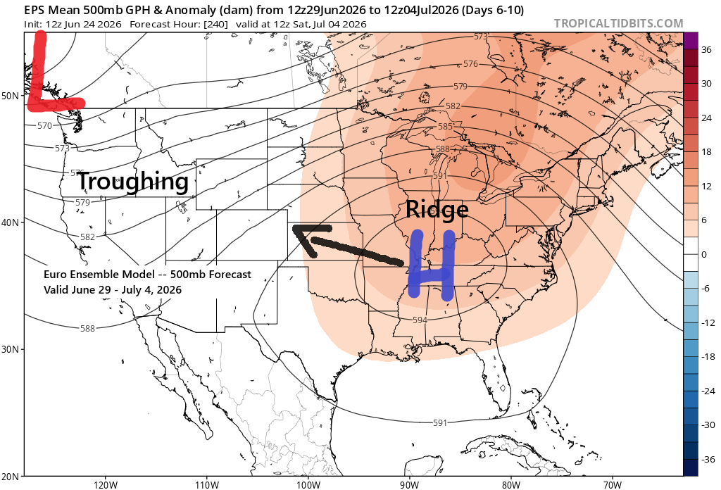
Heading into next week, computer models continue to show signs of a pattern shift, with an upper-level ridge developing across the Midwest and South and troughing out West. This setup will push much warmer air northward into the Upper Midwest, with 500mb heights likely topping 582 decameters and possibly exceeding…
-
Severe Storms Possible in the Northland Wednesday; Dense Fog Tonight
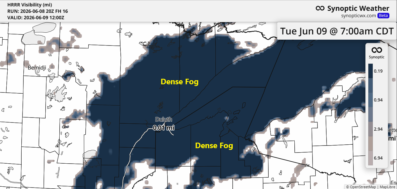
Humid air from Lake Superior will create widespread fog around the lake tonight into Tuesday morning, reducing visibility to a quarter mile or less in some areas. The fog is expected to clear by Tuesday afternoon, but more dense fog may return Tuesday evening and linger until Wednesday morning. …Severe…
-
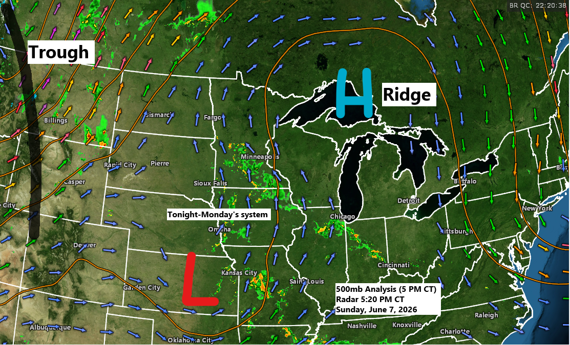
A few chances of rain this week, with warm and humid conditions inland and cooler temperatures near the lake.
A disturbance moving north from the central Plains, along with some lift and increasing moisture—bringing precipitable water up to 1.50 to 1.90 inches—will likely bring rain to northeast Minnesota and northwest Wisconsin late tonight into Monday. With the added moisture, some downours are possible, and while an isolated thunderstorm could…
-
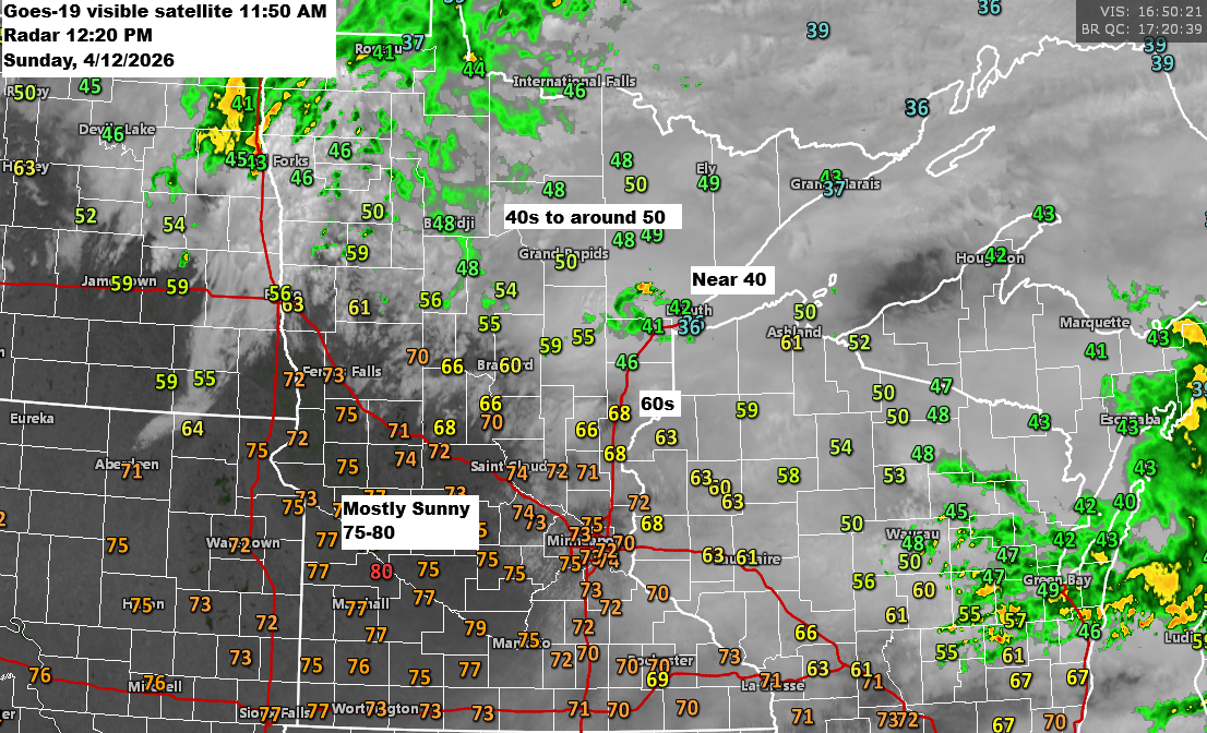
12 PM Weather Update for 4/12/2026: There’s a low chance of isolated strong to severe thunderstorms developing late this afternoon into the early evening.
Early this afternoon finds an area of low pressure over eastern North Dakota near Fargo with a warm front draped southeast through central Minnesota into central Wisconsin. For the rest of the day, the low will drift east-northeast, pushing the warm front farther north, while a cold front sweeps southeast…