Tag: Duluth weather
-
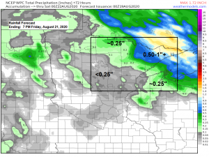
Turning more humid the next few days with chances for a few showers/t-storms; much cooler risks (patchy frost?) ~August 27-30
A northwest flow aloft will remain in place over the upper Midwest through Friday while a stationary front sets up near the Minnesota/Ontario border. Warm southerly winds will be found south of that boundary across the Northland through the end of the week with daytime highs in the mid 70s…
-
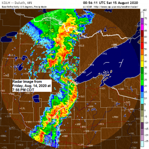
Updated – Storm Reports from around the Northland (8/14/2020)
Severe Thunderstorms producing damaging winds, flash flooding, funnel clouds and tornadoes moved through northeast Minnesota and northwest Wisconsin on Friday, August 14, 2020. Tornado – Lawler, Minnesota (Aitkin County) Date: August 14, 2020 Time: 6:57 PM – 7:02 PM CDT EF Rating: EF-1 Estimated Peak Winds: 90 mph Path Length:…
-
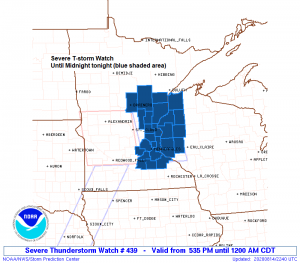
Severe Thunderstorm Watch issued for parts of the Northland
5:58 PM Friday – A severe thunderstorm watch has been issued for eastern Minnesota and western Wisconsin effective this Friday afternoon from 5:35 PM until Midnight CDT. Primary threats include Damaging wind gusts to 70 mph Large hail to 1.5 inches in diameter A tornado or two possible Counties in…
-
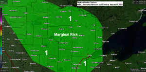
Weekend forecast for the Northland
For the most part this weekend looks pretty nice in northeast Minnesota and northwest Wisconsin with some sunshine expected both Saturday and Sunday, but there is one potential trouble spot, and that comes late Saturday afternoon through Saturday evening, this is when a few showers and thunderstorms are possible across…
-
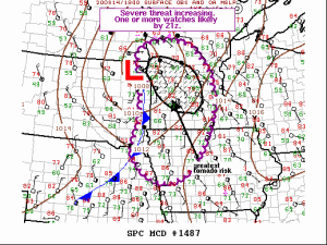
Update on the severe weather potential for late this afternoon into this evening
The Storm Prediction Center is monitoring much of central and southwest Minnesota for an increasing severe weather threat this afternoon with one or more watches likely by late this afternoon (by around 4 PM) There’s a 95% chance will see one or more watches issued by late this afternoon by…
-
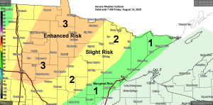
Scattered strong to severe thunderstorms through Friday evening; a few more storms possible Saturday night
A couple rounds of strong to severe thunderstorms are expected across northeast Minnesota and northwest Wisconsin from late this evening through Friday evening. Tonight’s severe weather risk is greatest across north-central Minnesota with an Enhanced risk of severe thunderstorms roughly along and west of a line from Walker to International…
-
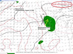
Some rain tonight and Thursday morning; a risk for strong to severe storms Thursday night and Friday; cooler risks next week
A pesky MCV or Mesoscale Convective Vortex has been holding together nicely as it moves east across western and central Minnesota today. This feature has already brought some rain to southern portions of the Northland today, mainly around the Brainerd lakes and Aitkin areas. This disturbance will continue to affect…