Tag: fog
-
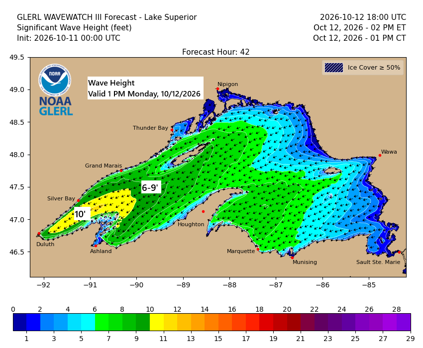
💨🌊🌧️Lake Superior Kicks Up: 45 MPH Gusts and 10-Foot Waves Possible
…Gales on western Lake Superior Monday… East to northeast winds will pick up over western Lake Superior on Monday, with gusts hitting 25 to 45 mph. Waves are expected to build to 5 to 10 feet, with the biggest swells likely from late morning through mid-evening. In Duluth, northeast winds…
-

Damp Tonight, Warm Tomorrow, Weekend Rain Still a Question Mark
Rain will linger over parts of the Northland this evening before easing, with areas of fog rolling in tonight and lasting into Wednesday morning. A cold front will sweep southeast through the region Wednesday afternoon and evening, bringing no precipitation but pushing temperatures up ahead of it, reaching the 70s…
-
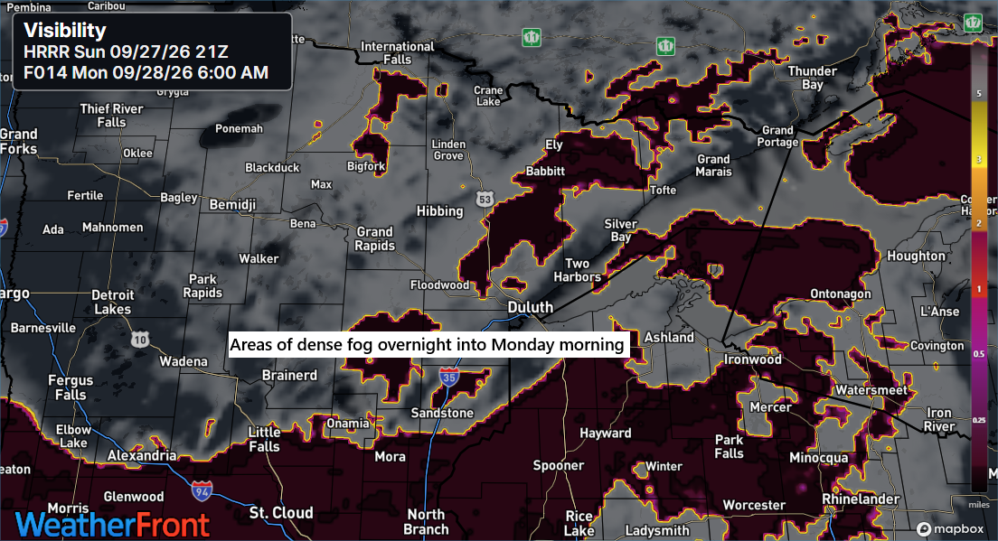
🌫️☔Fog rolls back into the Northland tonight, as Duluth marks its eleventh 70-degree day of September.
Fog is set to roll in across the Northland tonight, lingering into Monday morning before lifting by mid to late morning. In Duluth, today’s high of 70 marks the 11th time this month that temperatures have hit at least 70 degrees. The September average is nine days reaching 70 or…
-
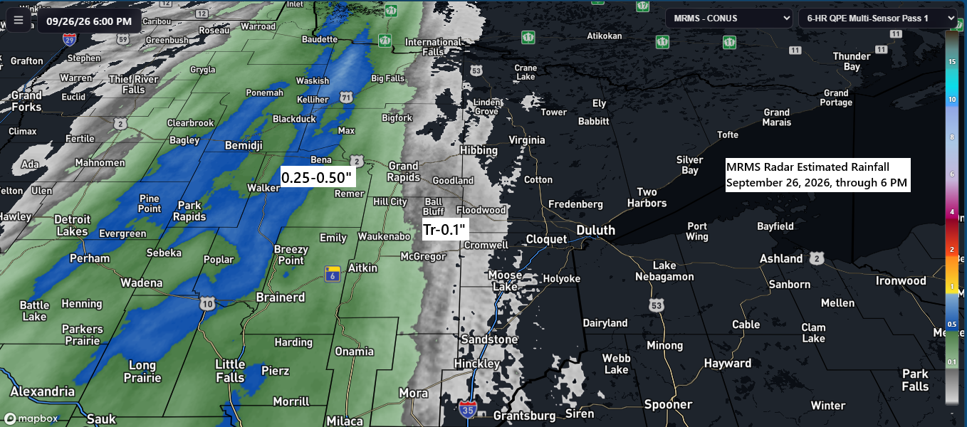
Half an Inch Here, Barely a Drizzle There
About half an inch of rain fell today in the far western parts of the Northland, including Cass Lake and Walker, while totals dropped to just 0.05 inches farther east in McGregor. Scattered showers will hang around the Northland tonight as today’s system moves northeast, with some patchy fog likely…
-
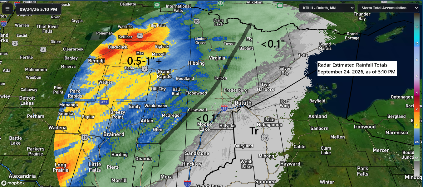
Northland Rainfall Totals for September 24, 2026
Today’s forecast played out pretty accurately, with the heaviest rain falling over the western parts of the area, where reports showed between half an inch and over an inch earlier today. Farther east, the rainfall was much lighter, totaling only a trace to less than 0.1 inches. Rainfall report for…
-
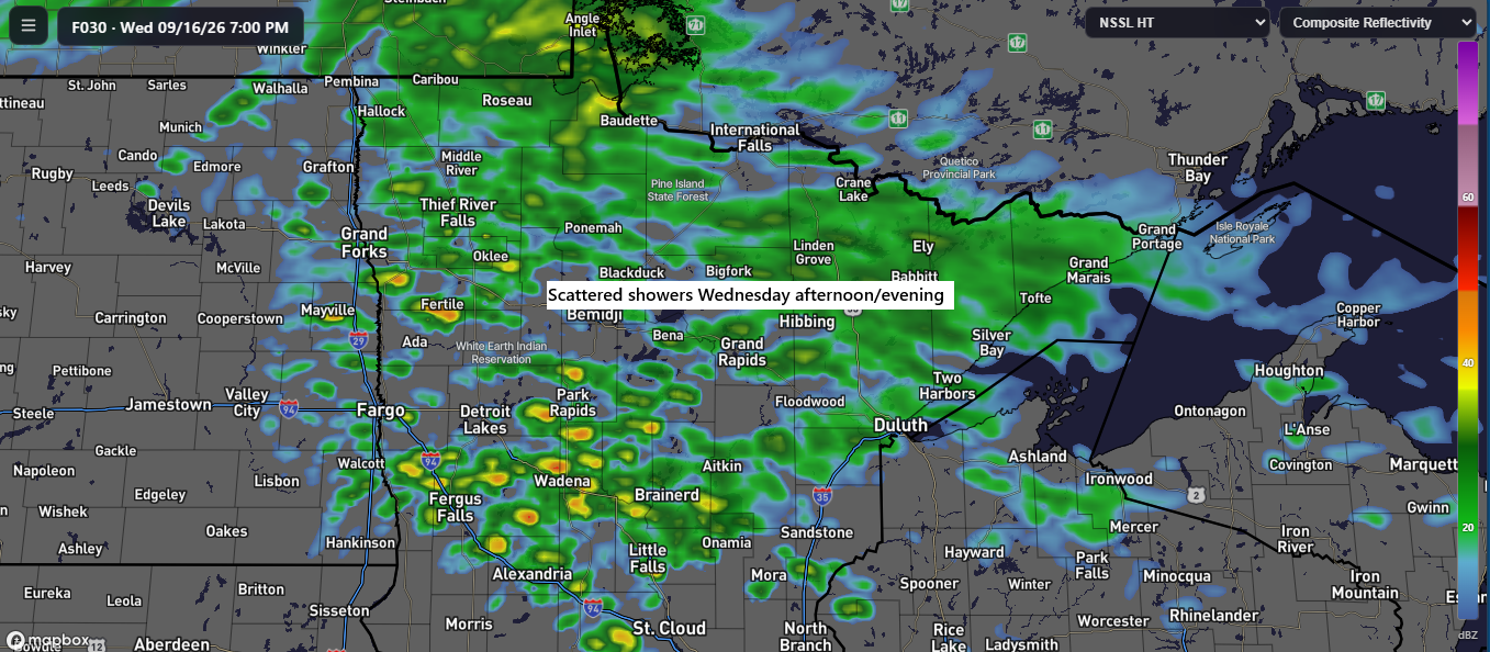
🌦️Scattered Wednesday Showers with an Uncertain Friday–Saturday Setup
Scattered showers may occur across the Northland Wednesday afternoon and evening, though rainfall amounts are expected to be light. After Monday’s rainfall in Duluth, here’s the latest update on precipitation statistics. Month to dateTotal: 3.15″Departure: +1.37″ Since January 1Total: 22.71″Departure: -0.43″ While precipitation in Duluth for 2026 is close to…
-
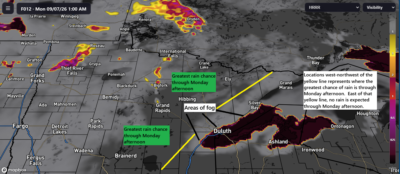
🌧️Rain Stays West Through Monday; Twin Ports Rain Arrives Monday Night
As expected, all off the weekend’s rain stayed west of the Twin Ports, and this pattern should continue through much of Monday. However, the chances for rain will increase Monday night into early Tuesday morning, with a few additional showers possible Tuesday afternoon. The bulk of the rainfall from this…