Tag: fog
-
🌧️🌩️Northland Thunderstorms Tonight: Heavy Rain, Hail and Gusty Winds
Showers and thunderstorms continue to track east across parts of the Northland late this afternoon. The main threats with these storms are from heavy downpours, lightning, gusty winds and hail. A few of the storms especially this evening may reach severe limits with winds to 65 mph and hail up…
-
🌧️Stalled Front to Bring Several Rounds of Rain into early next week; A Look at Duluth’s September Averages
A nearly stationary frontal boundary extending from the western High Plains to eastern Upper Michigan will serve as the focus for several rounds of showers and thunderstorms over the next few days. Tonight, most of the rain should remain south of the Northland; however, as the boundary gradually shifts north…
-
🌫️⚡Fog Settles In Tonight; Northern MN Storms Roll Through Overnight
Tonight, a warm front will advance east-northeast from southern Minnesota, while a cold front from the western Dakotas moves eastward. By Monday afternoon, the entire system is expected to have moved northeast of the Northland. Scattered showers have tracked east across parts of the Northland today, remaining brief and producing…
-
🌧️Heavier Rain Hits Central Minnesota and Western Wisconsin; Northland Experiences Lighter Totals
A frontal boundary will stay nearly stationary this weekend, extending from the Dakotas to southern Minnesota, well south of the Northland. South of this front, conditions will become increasingly muggy, with dew points reaching the 70s, while north of the boundary, dew points are expected to remain in the 50s…
-
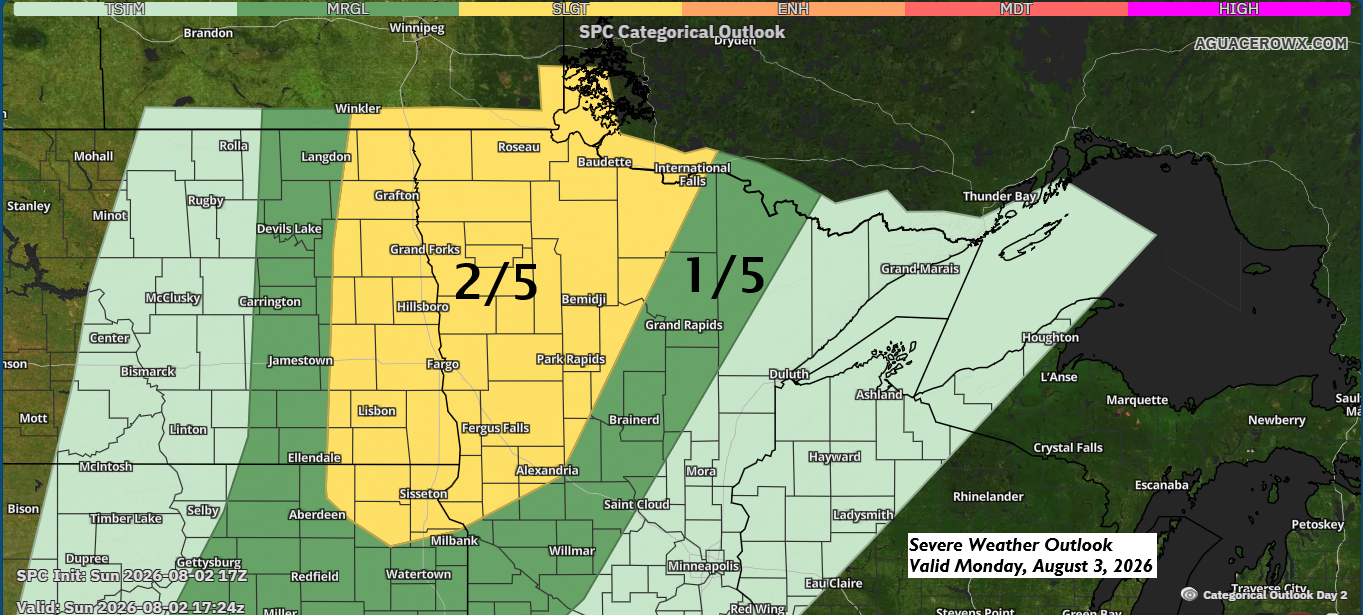
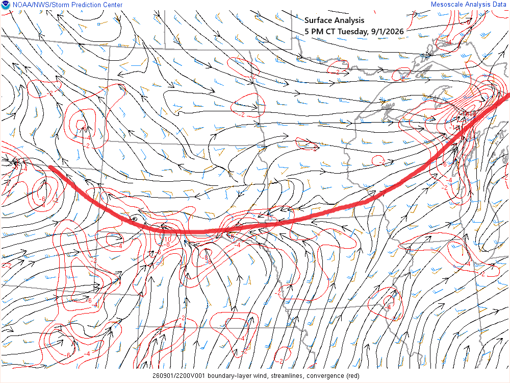
🌧️ Monday’s Storms Target Eastern ND and Western MN; Northland Sees Late‑Night Round
A cold front will move east from the Dakotas on Monday, crossing the Northland late Monday night into early Tuesday morning. It’s expected to bring the next round of rain to northeast Minnesota and northwest Wisconsin, though not everyone will get much, which is pretty typical for summer. Showers and…
-
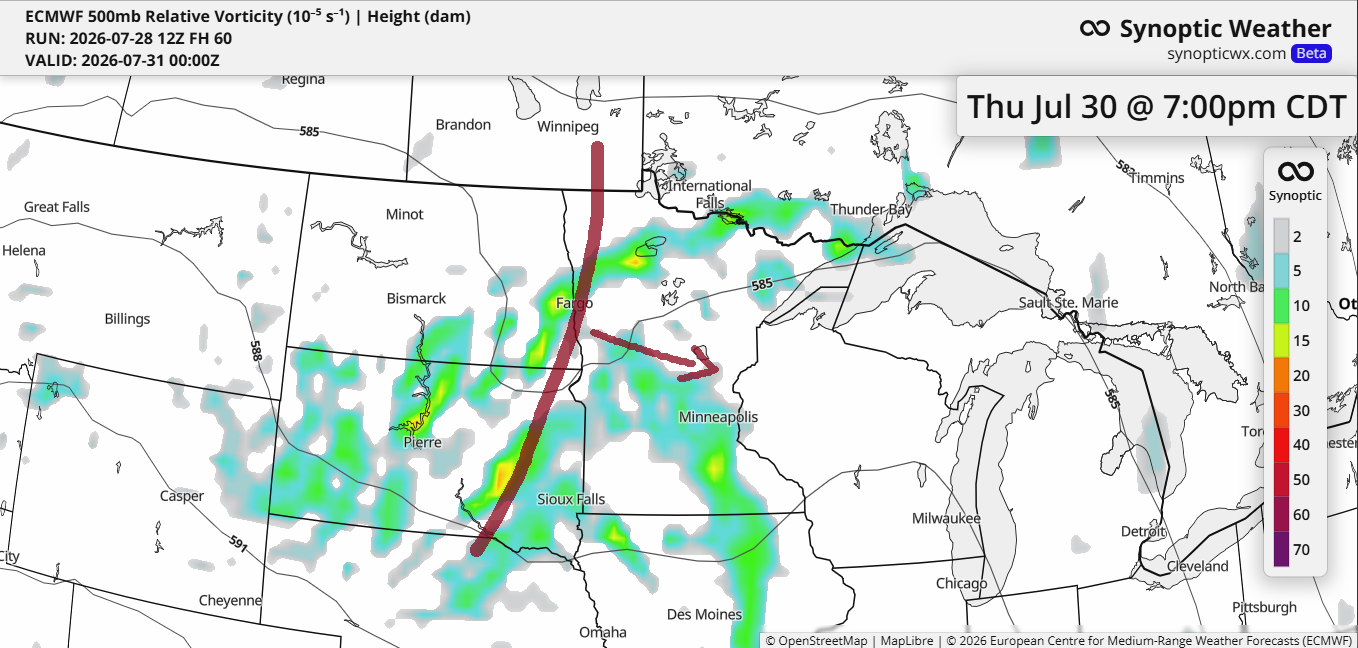
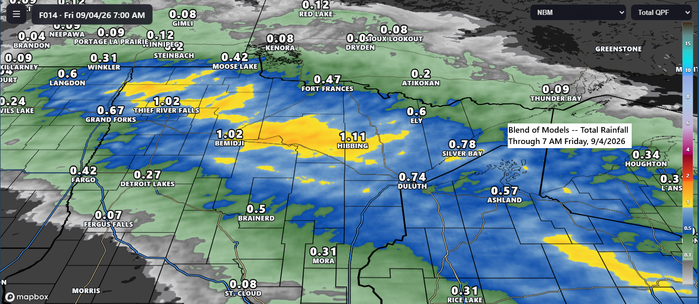
⛈️ Thursday–Friday Rainmaker: Plenty of Lift, Limited Severe Potential
From Thursday to Friday, a trough will slide southeast from the northern Plains, picking up a bit of strength along the way. With ample lift and moisture, it should bring some rain to much of the upper Midwest from Thursday into Friday. Scattered thunderstorms are likely given the instability, but…
-

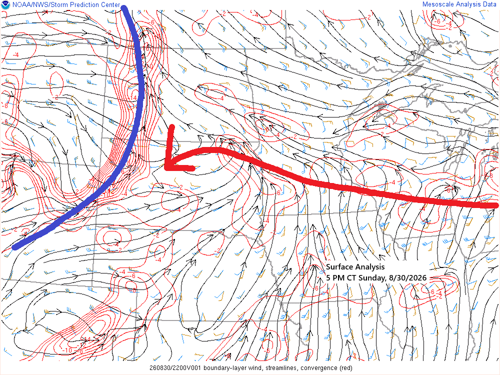
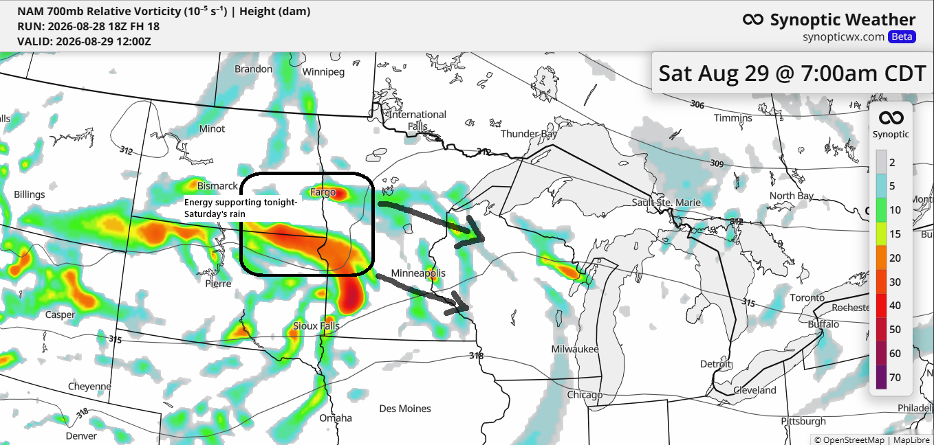
Weekend Northland Weather: Storm Chances, Low Clouds and Fog
One of the big unknowns about the weather through Saturday is just how much rain we’ll see in the Northland. And today, the computer models still don’t align very well. As has been the trend for the past few days, the Euro forecast remains much drier, especially around Lake Superior…