Tag: long range forecast
-

🌬️🌦️Chilly Air Aloft Could Spark Spotty Showers Wednesday
The next few days will be slightly cooler, but nothing too chilly, with highs ranging from the mid-50s to mid-60s across the area—pretty typical for early October. Cooler air aloft, with 500mb temperatures between -20 and -25°C, will move over the Northland on Wednesday. Combined with warmer surface conditions, this…
-
🌧️⚡🌡️Scattered Showers and an Isolated Storm Tonight; Summer-Like Warmth This Weekend
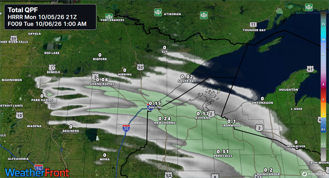
A burst of warm air and moisture, along with a southwesterly low-level jet picking up to about 30-40 knots and a warm front pushing east from western Minnesota, will bring scattered showers to parts of northeast and east-central Minnesota and northwest Wisconsin for a few hours tonight, with the best…
-
🌡️Big Changes Ahead: Freeze Alerts Now, Warm Surge Next Weekend
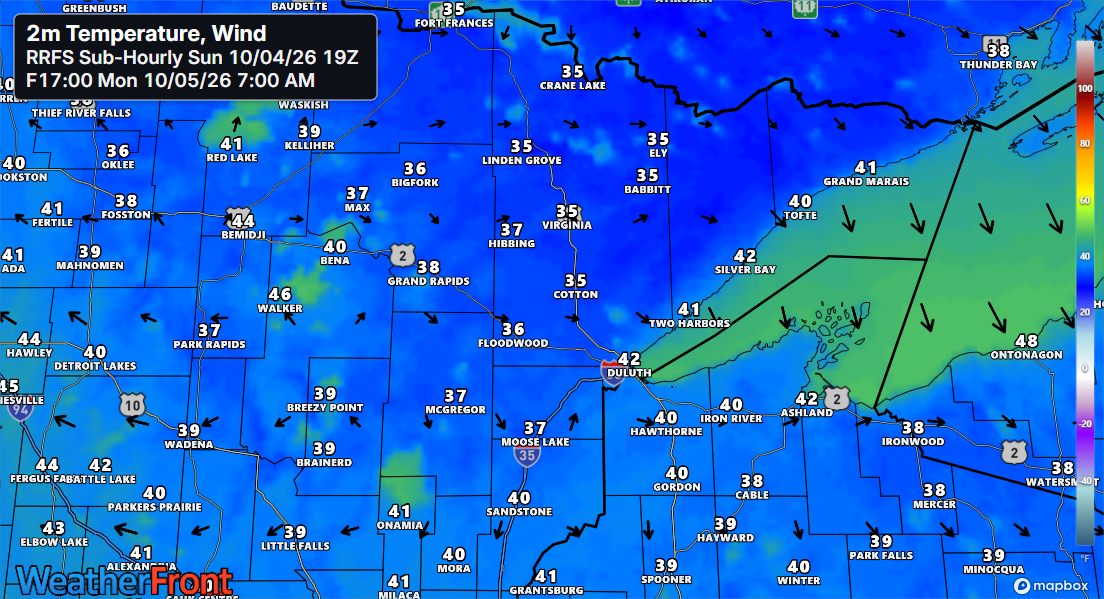
Freeze and frost alerts are in effect for early Monday morning across northeast Minnesota and northwest Wisconsin. Temperatures are expected to drop into the upper 20s to around 30 degrees in areas under the freeze warning, while those under the frost advisory will see lows in the low to mid-30s.…
-

Damp Tonight, Warm Tomorrow, Weekend Rain Still a Question Mark
Rain will linger over parts of the Northland this evening before easing, with areas of fog rolling in tonight and lasting into Wednesday morning. A cold front will sweep southeast through the region Wednesday afternoon and evening, bringing no precipitation but pushing temperatures up ahead of it, reaching the 70s…
-

🌧️Soaking Rains West, Slim Pickings East
There are no frost advisories in our area tonight for the first time in several nights. In fact, I don’t expect any frost threat to return until sometime next week. Rain will make its way back to parts of the Northland on Thursday, with the heaviest showers expected over western…
-
🥶🌧️Frost Tonight, Rain Thursday, and a Wetter Trend on the Horizon
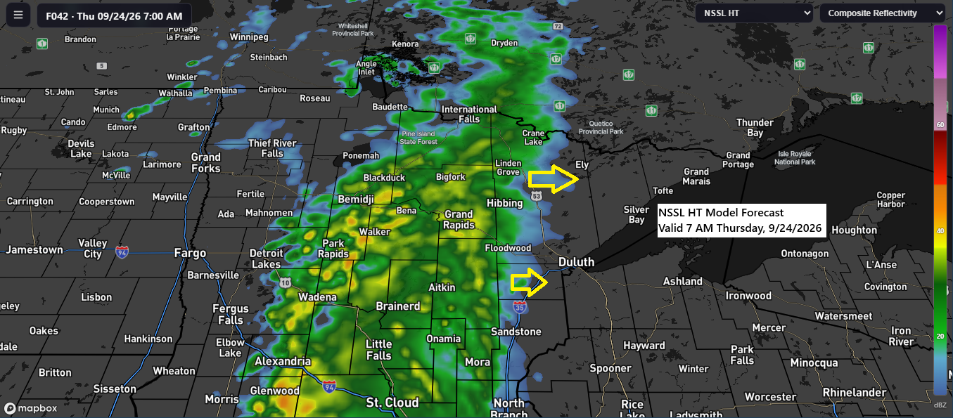
Rain might hit parts of the Northland on Thursday, but it’s unclear how far east it will go before tapering off. Right now, it seems the rain will reach as far east as the Arrowhead, North Shore, Twin Ports, and possibly into extreme northwest Wisconsin on Thursday, before breaking up…
-

🌤️🌦️Frost Advisory Tuesday Morning; Light Thursday Showers for Parts of the Northland
A Frost Advisory will be in effect early Tuesday morning for much of northeast Minnesota, excluding the North Shore, and for all of northwest Wisconsin. Forecasted temperatures reaching 34 degrees or lower are expected to produce frost, with the most significant risk occurring in areas inland from Lake Superior. No…