Tag: severe thunderstorms
-
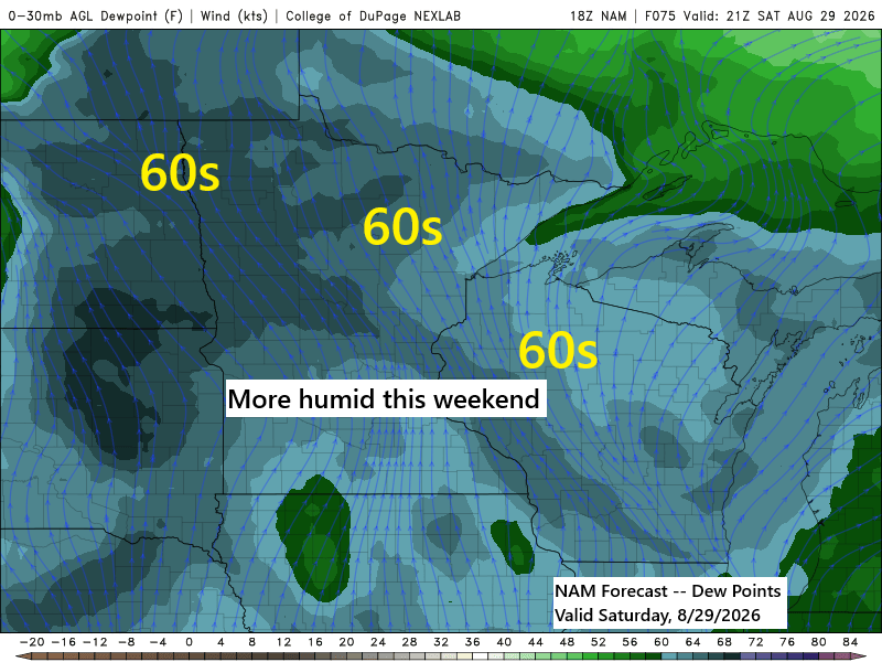
🌬️ Pattern Change Possible This Weekend into Next Week; 🌧️ Occasional Showers and Storms but Low Confidence in Widespread Rain
A pattern change could occur this weekend into next week, potentially bringing more persistent southwesterly winds aloft across the Upper Midwest. This is notable, as much of the summer has been dominated by a generally northwest flow aloft. It remains uncertain whether this will result in a wetter pattern for…
-
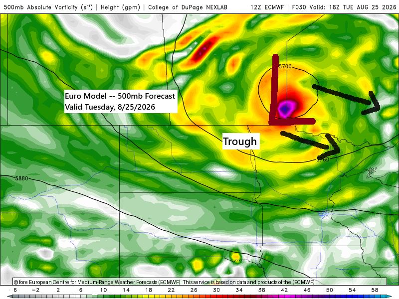
🌦️ Another Uneven Rain Event: Some Areas Soak, Others Miss Out
There’s another opportunity for rain in the Northland from late tonight through Tuesday evening, though, as we’ve seen this summer, some areas will receive more rain than others. Rainfall totals are anticipated to vary through Tuesday evening, ranging from approximately 0.05 inches to as much as one inch in locations…
-
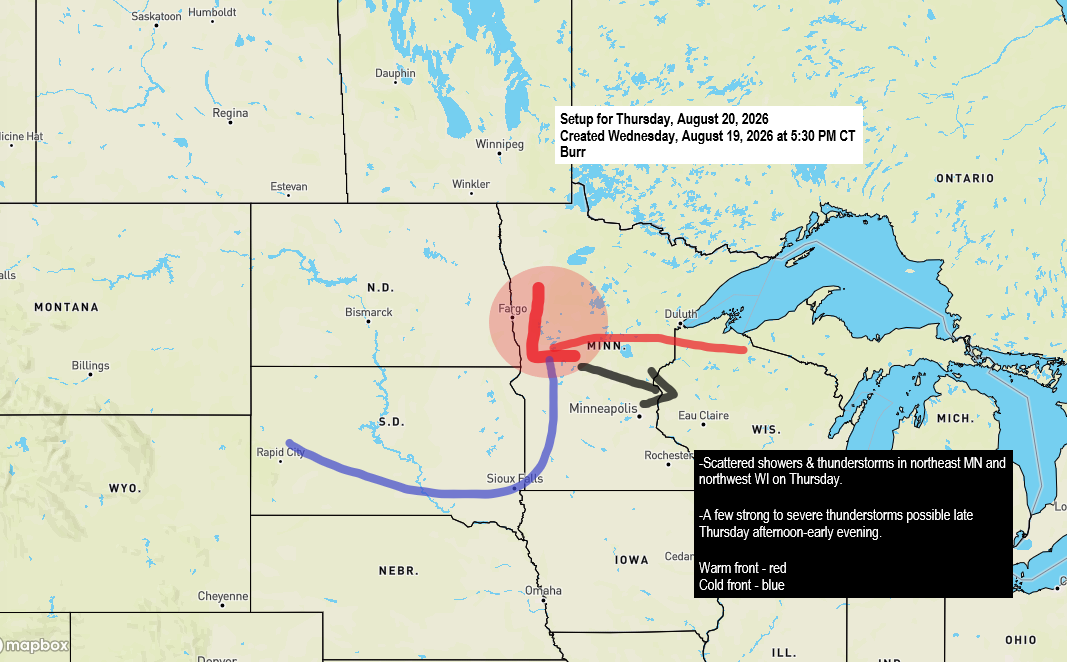
⚡ Morning Showers Then a Conditional Severe Threat Thursday Afternoon and Evening
There’s a chance of rain in the Northland on Thursday as a low-pressure system moves east-southeast from northern North Dakota, resembling a mid-August clipper. This system is expected to bring two rounds of precipitation. The first will occur during the morning and early afternoon, with scattered showers and isolated thunderstorms…
-

⛈️ Duluth Sees 1–5 AM Storm Window as Cold Front Approaches
A cold front will move east from western Minnesota across the Northland tonight, heading out by mid-morning Tuesday. Ahead of it, southerly winds will pull warm, humid air north, while cooler, drier air follows behind on northwest winds. This shift in wind direction along the boundary will create strong convergence,…
-
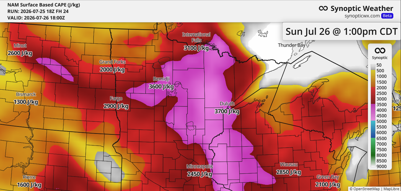
High Instability Sunday, but Cap Could Delay or Limit Storm Development
Scattered intense thunderstorms are possible in northeast Minnesota and northwest Wisconsin from Sunday into Sunday night. This threat is driven by strong mid and upper-level winds, high instability (CAPE), and steep mid-level lapse rates between 7 and 8.5 C/km across the Northland. Ample moisture will also be available, with dew…
-
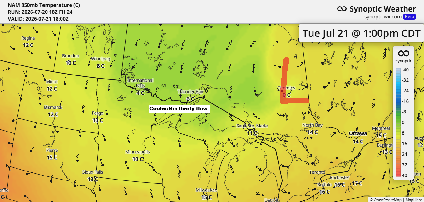
Duluth’s 12‑Day Run of 80° Highs Ends Tuesday as Cooler Air Moves In
After a stretch of very warm to hot weather in the Northland, a wave of cooler air is on its way for Tuesday and Wednesday. On Tuesday, 850mb temperatures are expected to drop to around +5 to +10°C in our area, the lowest in several weeks. This should mean daytime…
-
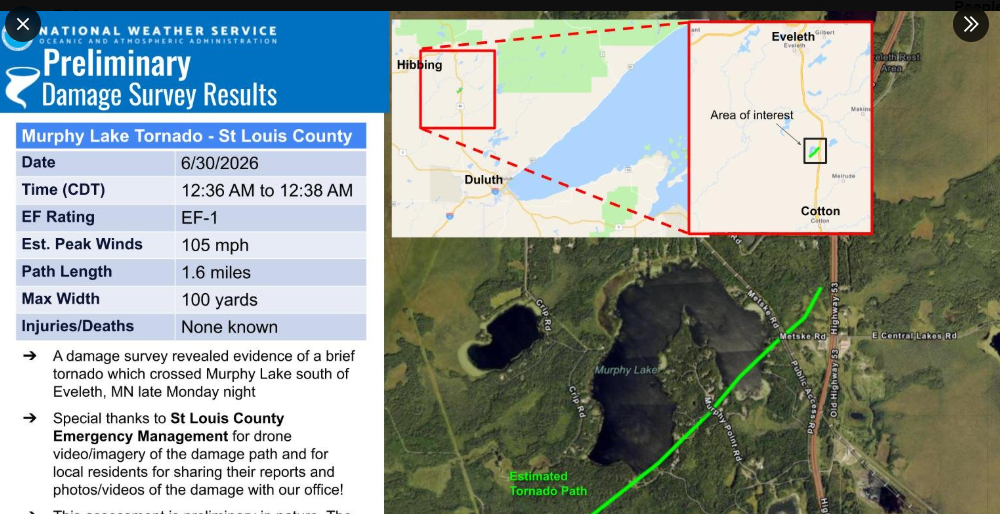
Murphy Lake EF-1 tornado details and Northland weekend forecast
Early Tuesday morning, June 30, 2026, a brief tornado touched down over Murphy Lake in central St. Louis County, Minnesota. Rating: EF-1Estimated Peak Wind: 105 mphPath length: 1.6 milesPath width: 100 yardsFatalities: 0Injuries: 0 Start date: June 30, 2026Start time: 12:36 AMStart location: 5 miles east-southeast of Zim End date:…