Tag: Lake Superior
-
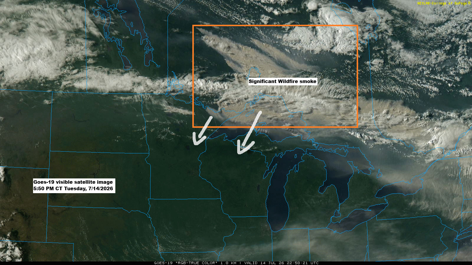
Wildfire Smoke Engulfs Northland: Air Quality Alert Through Friday
GOES-19 satellite images show thick plumes of wildfire smoke drifting from parts of Ontario into far northeast Minnesota and over Lake Superior this afternoon, mixing with some clouds. The smoke is expected to move southwest across the Northland, with air quality likely to worsen overnight into Friday morning. The smoke…
-
Northland Heat Wave, BWCA Fire Growth and Smoke Risk This Week
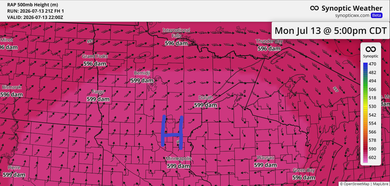
Today’s blog will take a bit longer to read, about five minutes, as there’s plenty of weather to cover, including fires and heat across the Northland. As expected, the ridge over the upper Midwest has reached near-historic levels for this far north, with the RAP model indicating 500mb heights hitting…
-
Minimal Lake Relief This Week as Fires Continue in Far Northern St. Louis County
Hot, dry weather will linger across the Northland for most of the week, with only a slight chance of cooler conditions near Lake Superior by mid to late week. Any relief from the lake will likely be minimal, as the water has warmed with mid-July’s arrival. …New record High Temperatures…
-
Low Overnight Storm Chances Tonight, Then a Remarkable 597–600 dam Ridge Builds Into the Northland Early Next Week
While chances are low, some model runs today suggest showers and thunderstorms could form over far northern Minnesota or southern Ontario tonight. If they do develop, they’d likely track southeast early Sunday morning. There’s plenty of instability and moisture in the air to support storms but rising heights from a…
-

Strong +3 Sigma Ridge Brings the Hottest Weather of Summer to the Northland
The upcoming 500mb ridge is expected to peak at about +2.5 to +3.0 sigma across the northern Plains and upper Midwest early next week, according to the GFS model. It’s quite an impressive ridge for this far north. High temperatures are expected to range from about 87 to 95 degrees…
-
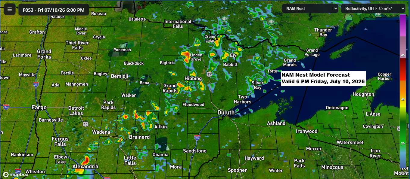
Northland Forecast: Storm Chances Friday, Then Intense Heat Builds
A northwest flow aloft, paired with some lingering moisture and instability over the Northland, along with a boundary moving in from the northwest, looks like it could spark a few showers and thunderstorms Friday afternoon into the evening. While severe weather doesn’t seem likely right now, that could change in…
-

Northern Minnesota Severe Thunderstorm Watch, More Rain Possible Midweek
A severe thunderstorm watch is in effect until 9 PM tonight for northern Minnesota and eastern North Dakota. The main threats include scattered damaging wind gusts between 60 and 75 mph, large hail measuring 1 to 2 inches in diameter (about the size of a quarter to a hen’s egg),…